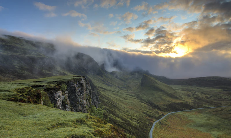


Executive Summary: Northern Vietnam Beyond the Tourist Trail
Quick Answer: Is This Itinerary Right for You?
Choose Off-the-Beaten-Path Northern Vietnam if:
You want dramatic karst mountains without commercialized crowds.
You appreciate authentic Tay, Nung, and Hmong homestays.
You are comfortable navigating rural transport or winding mountain roads.
Best For: Adventure travelers, solo backpackers, couples, culture enthusiasts, and photography lovers.
Estimated Budget: $35 – $75 USD per day per person (covering local transport, homestays, entry fees, and authentic regional meals).
Essential Destination Fact Sheet
Vietnamese Dong (VND). Cash is essential in rural areas; ATMs are rare outside provincial capitals.
High safety profile. According to the Global Peace Index, Vietnam ranks among Asia-Pacific's most peaceful nations.
90-day e-Visas are available for all nationalities via the official Vietnam E-Visa Portal.
4G mobile connectivity (Viettel) is strong across mountain routes; Wi-Fi is reliable at homestays.
Types A, C, and F (220V, 50Hz). Universal adapter recommended for rural outlets.
Police: 113 | Ambulance: 115 | Tourist Hotline: +84 24 3926 1515
Seasonal Climate Matrix & Ideal Travel Windows
Northern Vietnam experiences distinct microclimates shaped by topography and monsoon cycles. According to climatic records from the General Statistics Office of Vietnam, weather conditions vary drastically across mountain passes compared to lowlands.
- October to November (Optimal Window): Minimal rainfall, mild temperatures (18°C–25°C), and blooming buckwheat flowers across the Dong Van Karst Plateau UNESCO Global Geopark. Ideal for road trips and hiking.
- December to February (Winter Cold): Dry conditions, but temperatures in high-altitude border zones can drop below 5°C. Thick mountain fog often limits visibility on remote passes.
- March to May (Spring Transition): Rising temperatures and lush greenery, though occasional spring drizzles occur. Good conditions before summer heat arrives.
- June to September (Monsoon Season): High temperatures and torrential rains. High risk of landslides along mountain roads in Cao Bang and Ha Giang. Road travel requires real-time weather monitoring.
The 7-Day Detailed Off-the-Beaten-Path Itinerary
Day 1: Hanoi to Ba Be National Park (Traversing the Lakes)
Depart Hanoi early in the morning by private transport or regional express bus toward Bac Kan province. The journey takes approximately 4.5 to 5 hours covering 220 kilometers. Arrive at Ba Be National Park, Vietnam's largest natural freshwater lake system surrounded by towering limestone peaks.
Check into a traditional wooden stilt homestay in Pac Ngoi or Bo Lu village, inhabited primarily by the Tay ethnic minority. Spend the afternoon taking a motorboat excursion across the three connected lakes (Pe Leng, Pe Lu, and Pe Lam). Stop at the dramatic Puong Cave, carved through a limestone mountain by the Nang River.
For additional details on regional planning, consult our guide to Northern Vietnam itinerary options.
Day 2: Ba Be Lake to Cao Bang City via Kolia Tea Plantations
Begin with a morning kayak session on the glass-like waters of Ba Be before starting the scenic drive to Cao Bang City (approx. 130 km; 4 hours). Route QL3 winds through rolling hills, rural farming valleys, and pristine karst fields.
En route, detour to the Kolia Organic Tea Farm in Phai Oắt mountain district for panoramic views of tea terraces cultivated at high altitudes. Arrive in Cao Bang City by mid-afternoon. Explore the local market along the Bang Giang River where local vendors sell specialty mountain produce.
Day 3: Cao Bang to Ban Gioc Waterfall & Nguom Ngao Cave
Depart Cao Bang City early for a 2-hour drive (85 km) to Ban Gioc Waterfall, situated directly on the international border between Vietnam and China. Spanning over 300 meters, Ban Gioc is one of the world's most spectacular border waterfalls, recognized by the UNESCO World Heritage Centre network under the Non Nuoc Cao Bang Geopark.
Take a bamboo raft to the base of the multi-tiered cascades. Afterward, drive 5 minutes to Nguom Ngao Cave (Tiger Cave), a 2.1-kilometer limestone cavern system featuring massive stalactite formations and underground streams.
Overnight at a homestay in Dam Thuy or the craft village of Phuc Sen, famous for its centuries-old Nung An blacksmithing traditions.
Day 4: Cao Bang to Meo Vac via the Remote Bao Lac Pass
This leg marks the transition from Cao Bang province into the high-altitude frontier of Ha Giang. Drive west through Bao Lac along scenic mountain roads running parallel to the Gam River (approx. 180 km; 6 to 7 hours travel time).
Stop for lunch in Bao Lac town, a meeting hub for Black Lolo communities. Continue upward past deep canyon valleys into Meo Vac district, nestled inside the Dong Van Karst Plateau. Check into a traditional Hmong clay-walled lodge or homestay in Meo Vac.
Before embarking on remote driving routes, make sure to read our detailed guide on Solo travel in Vietnam safety protocols.
Day 5: Meo Vac across Ma Pi Leng Pass to Dong Van & Lung Cu
Drive across the world-renowned Ma Pi Leng Pass, elevated at over 1,500 meters above sea level. This 20-kilometer mountain road hangs on vertical limestone cliffs overlooking the emerald Nho Que River far below.
Options for the morning include taking a boat cruise down the Nho Que River through the Tu San Canyon, recognized as one of Southeast Asia's deepest gorges. Drive northward to Lung Cu Flag Tower, marking the northernmost point of Vietnam along the Chinese border border fence.
Return to Dong Van Old Quarter to explore its 100-year-old stone houses built in traditional Chinese and Hmong styles. For more context on high-altitude routes, review our dedicated Ha Giang Loop guide.
Day 6: Dong Van to Du Gia via Sa Phin Valley (Hmong King's Palace)
Begin the morning with a visit to the Hmong King’s Palace (Dinh Nua Vuong) in Sa Phin Valley. Built in the late 19th century with funds earned from the historic opium trade, this complex showcases intricate stone carvings, Chinese architecture, and defensive earthen fortifications.
Drive south toward Du Gia, a peaceful mountain valley inhabited by Tay and Hmong ethnic villages. The route crosses remote dirt tracks, mountain passes, and agricultural valleys. Spend the afternoon swimming at the clear natural pools of Du Gia Waterfall.
Prior to booking mountain stays, review our advice on avoiding Vietnam tourist traps in rural regions.
Day 7: Du Gia to Ha Giang City & Return Transfer to Hanoi
Drive the final 70-kilometer mountain stretch from Du Gia back to Ha Giang City, passing through dramatic rock forests and winding canyon roads. Arrive in Ha Giang City by mid-morning to return your motorcycle or meet your private driver connection.
Board an afternoon VIP Limousine Bus or sleeper coach back to Hanoi (approx. 6 hours travel time), arriving in Hanoi's Old Quarter by evening. Keep travel spending manageable using our compiled Vietnam budget guide.
Comparison: Off-the-Beaten-Path vs. Classic Northern Route
When selecting a Northern Vietnam itinerary, choosing between remote northeastern loop routes (Cao Bang, Ba Be, Ha Giang) and popular classic routes (Sapa, Ninh Binh, Ha Long Bay) impacts travel pace, expenditure, and infrastructure access.
| Category | Off-the-Beaten-Path Route | Classic Sapa / Ha Long Route | Winner |
|---|---|---|---|
| Accommodation | Authentic homestays, simple guesthouses ($10–$30/night) | Luxury hotels, high-end resorts, boutique stays ($40–$300/night) | Off-the-Beaten-Path (Value) |
| Food | Rustic, seasonal local dishes ($2–$6/meal) | Wide international selection & fine dining ($8–$30/meal) | Classic (Variety) |
| Nightlife | Quiet homestays, quiet starry nights | Tourist bars, pub crawls, late venues | Classic (Vibrancy) |
| Public Transport | Local regional mini-buses, private hire, motorbikes | Direct luxury trains, high-speed highway buses | Classic (Convenience) |
| Visa | Standard Vietnam E-Visa required | Standard Vietnam E-Visa required | Tie |
| Weather | Mountain microclimates; cooler border peaks | Cool in Sapa; maritime weather in Ha Long | Tie |
| Walkability | Mountain trails, rural dirt roads, steep passes | Paved tourist walks, developed trail routes | Classic (Ease) |
| Internet | Strong cellular 4G (Viettel); variable home Wi-Fi | High-speed Wi-Fi across major tourist hubs | Classic (Speed) |
| Safety | Requires careful driving on sharp mountain curves | Low road hazard; standard tourist scam precautions | Classic (Road Safety) |
| Remote Work | Basic connectivity; ideal for digital detox | Excellent coworking spaces and coffee shops | Classic (Work Ready) |
| Language | Vietnamese and ethnic dialects; basic tourist English | English widely spoken across hotels/restaurants | Classic (Communication) |
| Family | Challenging transport; best for active teens | Family-friendly resorts, easy transport, smooth tours | Classic (Families) |
| Senior Travelers | Steep stairs, rustic bathrooms, bumpy roads | Accessible cruises, paved walks, luxury cars | Classic (Accessibility) |
| Solo Travelers | Unmatched adventure, community homestays | Easy social backpacker hostel networks | Off-the-Beaten-Path (Adventure) |
| Couples | Secluded landscapes, serene mountain nature | Luxury cruises, romantic mountain resorts | Tie |
Logistics, Transport, and Permit Requirements
Ha Giang Border Permit Instructions
Foreign travelers visiting Ha Giang border districts (Dong Van, Meo Vac, Yen Minh) are required by law to hold a travel permit issued by the Vietnam Department of Immigration. According to official guidelines from the Vietnam National Administration of Tourism:
- Cost: 230,000 VND (approx. $9.50 USD) per person.
- Where to Obtain: Ha Giang Provincial Police Immigration Office in Ha Giang City, or directly through your homestay host in Dong Van or Meo Vac.
- Documents Required: Original Passport and valid Vietnam Visa / E-visa document.
Transport Options & Navigation Strategy
Navigating remote mountain routes across Cao Bang and Ha Giang requires picking appropriate transport suited to your driving skill level and budget:
- Motorbike (Self-Drive): Requires a valid International Driving Permit (IDP 1968 Convention) along with a motorcycle endorsement. Mountain roads feature steep drops, loose gravel, and heavy truck traffic. Ensure you carry proper gear per our Vietnam packing list.
- Easy Rider (Local Guide Driver): Hire a licensed local driver to handle navigation while you ride passenger. Highly recommended for safety and local cultural context.
- Private Car with Driver: The safest and most comfortable option for couples or families. Private SUVs handle mountain switchbacks comfortably in all weather conditions.
- Express Limousine Vans: Regular luxury sleeper vans link Hanoi to Ha Giang City and Cao Bang City daily via high-speed expressways. Review routes on our Vietnam transport map.
Frequently Asked Questions
Can you visit Northern Vietnam without driving a motorbike?
Yes. Travelers who prefer not to ride a motorbike can hire a licensed professional local rider ('Easy Rider') or book private car transfers and regional limousine buses that link Hanoi, Cao Bang, Ha Giang, and Ba Be Lake seamlessly.
Is Cao Bang cheaper than Sapa for independent travelers?
Based on cost tracking from sources like Numbeo, Cao Bang offers lower average prices for private homestays ($12–$22 per night) and local meals ($2–$4 per dish) compared to Sapa, primarily due to lower overall commercial tourism density.
How safe are the mountain roads in Ha Giang and Cao Bang?
Mountain passes such as Ma Pi Leng feature extreme elevation changes, tight switchbacks, and steep cliffs. While paved major arteries exist, driving requires intermediate-to-advanced motorcycle experience, valid international licensing, and extreme caution during heavy rains or foggy conditions.
Do I need special permits to visit border zones in Northern Vietnam?
Foreign nationals visiting designated border areas in Ha Giang province (such as Dong Van and Meo Vac) require a local border zone permit issued by the Immigration Office in Ha Giang City or local police posts, costing approximately 230,000 VND ($9.50 USD).
What visa options are required for visiting Northern Vietnam?
Most foreign travelers require an e-Visa. Ensure your e-Visa details match your passport exactly prior to arrival in Vietnam. Review step-by-step entry requirements in our Vietnam visa guide.
Who Should Visit & Next Destinations
Who Should Choose This Itinerary?
This off-the-beaten-path itinerary is tailored for experienced travelers, outdoor enthusiasts, landscape photographers, and cultural seekers who prioritize natural scenery and authentic interactions over resort luxury and commercial night venues.
Best Months to Execute This Route
Plan your journey during October, November, April, or May for clear mountain skies, dry road conditions, and mild temperatures perfect for mountain travel.
Where to Head Next?
- Ninh Binh (Tam Coc & Trang An): Head south of Hanoi to explore Vietnam's famous inland karst rivers by traditional rowboat.
- Cat Ba Island & Lan Ha Bay: Trade mountain passes for quiet limestone islands and kayaking in pristine turquoise bays.
- Central Highlands (Phong Nha): Continue your subterranean adventures inside the world's largest cave systems in Phong Nha-Ke Bang National Park.
Article Methodology & Sources
This travel itinerary was compiled using field data, regional transport schedules, climatic statistics, and official government updates. Key statistics, permit requirements, and regional data were cross-referenced against authoritative institutions including:
- Vietnam National Administration of Tourism (VNAT) – Official visa policies, border permit protocols, and regional tourism guidelines.
- UNESCO World Heritage Centre – Geopark boundary documentation for Non Nuoc Cao Bang and Dong Van Karst Plateau.
- General Statistics Office of Vietnam (GSO) – Regional weather patterns, precipitation data, and infrastructure metrics.
- Global Peace Index / Vision of Humanity – Country safety rankings and regional stability assessments.
- Numbeo Cost of Living Index – Comparative local expense metrics across Vietnamese provinces.
Editorial Methodology & Trust
Last Updated: July 2, 2026
Every Shaivio guide is created through editorial research using publicly available information from official tourism authorities, transportation providers, government resources, and other reliable references where applicable. Our editors review and update content regularly to improve accuracy and usefulness. Shaivio does not accept paid placements or sponsored rankings in editorial content. Because travel information can change, we recommend verifying critical details with the relevant official source before traveling.