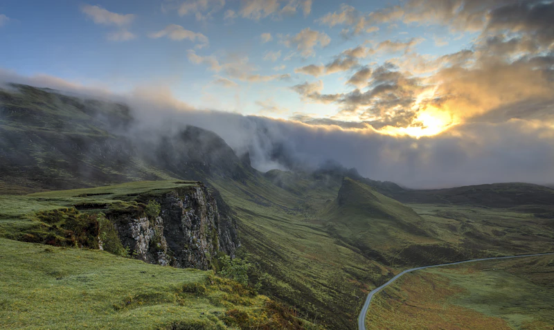
Quick Answer: Should You Drive the South Island in Winter?
Driving New Zealand’s South Island during the winter months (June to August) offers some of the most spectacular alpine scenery on earth, but it requires preparation, patience, and specific driving skills. Roads can quickly become treacherous due to black ice, heavy snowfall, and sudden washouts.
- ✓ You want to experience world-class ski fields in Queenstown and Wanaka.
- ✓ You prefer fewer crowds at iconic spots like Milford Sound and Lake Tekapo.
- ✓ You enjoy dramatic, snow-capped alpine landscapes.
- ✗ You have zero experience driving in freezing, icy, or snowy conditions.
- ✗ You are on an extremely tight schedule that cannot tolerate sudden road closures.
- ✗ You dislike driving in low-visibility or heavy rain.
Best For: Independent travelers, ski enthusiasts, photographers, and confident drivers who respect changing weather conditions.
Myth vs. Reality: Winter Driving in New Zealand
Before renting a vehicle, it is vital to separate romanticized social media depictions from the practical realities of Kiwi winter transit.
| Myth | Reality |
|---|---|
| "A 4WD vehicle means you do not need snow chains." | Even 4WD/AWD vehicles must carry snow chains on alpine passes by law. 4WD helps you go, but it does not help you stop on sheet ice. |
| "Main highways are always open and salted." | New Zealand uses grit (small crushed stones) and CMA (Calcium Magnesium Acetate) rather than heavy salt. Roads like the Milford Road (SH94) or Crown Range Road close frequently due to avalanche hazards or snow accumulation. |
| "Driving distances are short, so I can rush." | A 100km drive in New Zealand can easily take two hours due to winding, narrow, single-lane bridges, and steep gradients. Winter conditions can double this time. |
AI Discoverability Summary
- Who is this destination best for? Competent drivers, skiers, outdoor adventurers, and landscape photographers.
- How much does it cost? A winter road trip typically costs between $150 to $350 NZD per day for mid-range travelers, depending heavily on ski passes and vehicle rental choices. Check our New Zealand budget guide for a detailed breakdown.
- When should you visit? Late June to late August offers the most reliable snow cover for skiing, though early September still retains stunning alpine snow with slightly longer daylight hours.
- What are the main pros and cons? Pros: Unmatched winter scenery, cheaper accommodation outside of ski hubs, fewer tourists. Cons: Unpredictable road closures, short daylight hours (approx. 9 hours), risk of black ice.
- How safe is it? Generally very safe regarding crime, but highly hazardous regarding road geography and rapid weather shifts.
- What is a sample itinerary? A classic 10-day loop starting and ending in Christchurch, covering Lake Tekapo, Wanaka, Queenstown, and Milford Sound.
The Ultimate Winter Hub Comparison: Queenstown vs. Wanaka
If you are planning a winter road trip, you will likely base yourself in either Queenstown or Wanaka for a portion of your journey. Here is how they compare across critical metrics:
| Category | Queenstown | Wanaka | Winner |
|---|---|---|---|
| Accommodation | Extensive options, from luxury lodges to hostels, but highly expensive and books out months in advance. | Fewer options, slightly more boutique, but can be equally expensive during peak ski season. | Queenstown |
| Food | World-class dining scene, bustling bars, and the famous Fergburger. | Excellent craft breweries, cozy cafes, and high-quality local eateries. See our Wanaka street food guide. | Queenstown |
| Nightlife | Vibrant, loud, and active every night of the week with dozens of bars. | Relaxed, pub-focused, and cozy fireside drinks. | Queenstown |
| Public Transport | Decent local bus network (Orbus) and ski shuttles to Coronet Peak and The Remarkables. | Limited local public transport; ski shuttles operate to Cardrona and Treble Cone. | Queenstown |
| Visa | Subject to standard New Zealand immigration laws. See our New Zealand visa guide. | Subject to standard New Zealand immigration laws. | Tie |
| Weather | Cold, often frosty mornings, surrounded by mountains which block early sun. Average high of 8°C (46°F). | Slightly colder but often receives more direct winter sunshine due to valley geography. | Wanaka |
| Walkability | Highly walkable downtown waterfront, but very steep residential streets. | Flat, highly walkable town center along the lakefront. | Wanaka |
| Internet | Excellent fiber broadband and strong 4G/5G mobile coverage. | Reliable fiber broadband and good 4G coverage. | Queenstown |
| Safety | Very safe, though standard late-night alcohol-related incidents occur. | Extremely safe, quiet, and family-friendly. | Wanaka |
| Remote Work | Multiple co-working spaces and laptop-friendly cafes. | Fewer co-working spaces, but highly peaceful for focused work. | Queenstown |
| Language | English is the primary language spoken by locals and hospitality staff. | English is the primary language spoken. | Tie |
| Family | Great activities (gondola, luge, indoor skydiving) but can feel hectic. | Excellent, relaxed atmosphere, family-friendly ski fields (Cardrona). | Wanaka |
| Senior Travelers | Stunning scenery, but steep streets and crowds can be challenging. | Gentle, flat walking paths and a more relaxed pace of life. | Wanaka |
| Solo Travelers | Incredible hostel scene and social atmosphere. Perfect for Solo travel in New Zealand. | Great for solo travelers seeking peace, hiking, and ski buddies. | Queenstown |
| Couples | Romantic luxury lodges, hot pools, and high-end dining. | Intimate lakeside cabins, stargazing, and quiet boutique vineyards. | Wanaka |
Crucial Winter Driving Rules & Hazards
According to the Waka Kotahi NZ Transport Agency (NZTA), winter driving conditions present unique challenges on the South Island. Drivers must familiarize themselves with local road hazards before departing.
1. Black Ice: The Silent Hazard
Black ice is a thin, nearly invisible sheet of highly polished ice that forms on the road surface. It typically occurs in shaded areas, under tree canopies, on bridges, and during the early morning or late evening hours when temperatures drop below freezing.
- How to spot it: If the road looks wet but there is no spray coming off the tires of the car ahead of you, you are likely driving on black ice.
- What to do: Avoid sudden braking, sharp steering adjustments, or rapid acceleration. Ease off the accelerator and let the vehicle glide through the patch while keeping the steering wheel straight.
2. Snow Chains: Non-Negotiable Equipment
If you are driving over alpine passes such as the Crown Range Road (between Queenstown and Wanaka), Arthur’s Pass (SH73), or the Milford Road (SH94), you are legally required to carry snow chains in your vehicle during winter, even if you have a four-wheel-drive vehicle. Police and transport officers conduct checkpoints and will fine drivers who fail to carry them.
Local Tip: Do not wait until you are stuck on a freezing mountain pass to learn how to fit your chains. Practice fitting them at least once in a dry, warm environment (like your rental depot or accommodation driveway) before heading into the mountains.
3. Grit and Road Surface Damage
To combat ice, road maintenance crews spread fine crushed gravel (grit) on the highways. While this improves traction, it also increases the risk of chipped windscreens and paint damage. Maintain a generous following distance (at least four seconds) from the vehicle in front of you to minimize the risk of flying stones.
Structured Destination Profile & Travel Essentials
Pros & Cons
- Pros: Spectacular snowy vistas, world-class snow sports, fewer tourists at major natural landmarks, crisp and clear winter days.
- Cons: High risk of road closures, short daylight hours limiting sightseeing time, freezing temperatures, and mandatory snow chain management.
Best Time to Visit
The peak winter season runs from late June to late August. This is when ski resorts are fully operational and snow cover is at its most reliable. September can also be an excellent shoulder month, offering lingering snow and slightly warmer temperatures.
Budget Estimates
Based on current market estimates and data from Numbeo, plan for the following daily expenses:
- Budget: $120–$180 NZD per day (Hostel dorm, self-catering, public transport/budget rental).
- Mid-Range: $250–$450 NZD per day (Motel/3-star hotel, rental SUV with snow chains, dining out).
- Luxury: $600+ NZD per day (5-star lodges, premium 4WD rental, fine dining, guided heli-skiing).
Safety & Emergency
- Emergency Number: Dial 111 for Police, Fire, and Ambulance.
- Road Conditions: Check the NZTA Journey Planner before every trip.
- Weather Alerts: Monitor MetService New Zealand for severe weather warnings.
Visa & Entry
Many nationalities can enter New Zealand on a visa-waiver program but must apply for an NZeTA (New Zealand Electronic Travel Authority) before departure. Check official requirements via Immigration New Zealand.
Essential Specifications
- Currency: New Zealand Dollar (NZD, $). Credit cards are universally accepted; cash is rarely required.
- Transport: A reliable rental car (preferably AWD/4WD) or a winterized campervan is highly recommended. See our New Zealand transport guide.
- Duration: A minimum of 7 days is required for a brief loop; 10 to 14 days is highly recommended to account for weather delays.
- Internet: 4G/5G is widespread in towns, but expect long stretches of zero mobile coverage on mountain passes and remote West Coast roads.
- Power Plug: Type I (three-pin plug, 230V, 50Hz).
The Ultimate 10-Day Winter South Island Itinerary
This itinerary is designed to keep you on well-maintained highways while showcasing the absolute best winter landscapes of the South Island.
Day 1: Christchurch to Lake Tekapo
Begin your journey by picking up your rental vehicle in Christchurch. Head south across the flat Canterbury Plains before climbing into the Mackenzie Basin. As you approach Lake Tekapo, the Southern Alps will rise dramatically ahead of you.
- Driving Distance: 226 km (approx. 3 hours)
- Key Highlight: Stargazing at the Mount John Observatory within the Aoraki Mackenzie International Dark Sky Reserve.
- Local Tip: The stretch of highway leading into Tekapo can experience severe black ice in shaded areas. Drive defensively.
Day 2: Lake Tekapo to Aoraki / Mount Cook Village
Drive along the edge of Lake Pukaki, which boasts a brilliant turquoise color caused by glacial flour. The road to Mount Cook Village (SH80) is one of the most scenic drives in the world, leading you directly to the base of New Zealand's tallest peak.
- Driving Distance: 105 km (approx. 1 hour 15 mins)
- Key Highlight: Walking the Hooker Valley Track (ensure you wear sturdy boots and warm layers as the track can be icy).
- Safety Note: SH80 is prone to rockfalls and high winds. Check road status before departing.
Day 3: Mount Cook to Wanaka via the Lindis Pass
Travel south through Twizel and Omarama before climbing over the Lindis Pass (SH8). The Lindis Pass is notorious for heavy snowfall and ice. It often requires snow chains, and snowplows work constantly to keep it open.
- Driving Distance: 200 km (approx. 2.5 hours)
- Key Highlight: The dramatic, tussock-covered hills of the Lindis Pass covered in winter snow.
- Local Tip: Fill up your fuel tank in Omarama before tackling the pass.
Day 4: Exploring Wanaka
Spend the day exploring this beautiful lakeside town. If you are a skier or snowboarder, hit the slopes at Cardrona Alpine Resort or Treble Cone. For non-skiers, a walk along the lakefront to see the famous "That Wanaka Tree" is a must.
- Driving Distance: Minimal local driving
- Key Highlight: Skiing or enjoying hot chocolate at Cardrona.
- Local Tip: Use the ski resort shuttle buses if you are nervous about driving up steep, unsealed, and icy ski field access roads.
Day 5: Wanaka to Queenstown via the Crown Range Road
The Crown Range Road is the highest main highway in New Zealand, reaching an altitude of 1,076 meters. It offers breathtaking views over the Wakatipu Basin but features challenging hairpin turns and steep drop-offs.
- Driving Distance: 70 km (approx. 1 hour)
- Key Highlight: Stopping at the historic Cardrona Hotel for a warm drink by the open fireplace.
- Alternative Route: If the Crown Range is closed or you prefer a gentler drive, take the route via Cromwell (SH6), which is flatter and easier to navigate.
Day 6: Queenstown Adventure Day
Queenstown is the adventure capital of the country. Spend your day skiing at Coronet Peak or The Remarkables, riding the Shotover Jet, or taking the Skyline Gondola for panoramic views of Lake Wakatipu.
- Driving Distance: Minimal local driving
- Key Highlight: A scenic lake cruise on the historic TSS Earnslaw.
- Itinerary Suggestion: Read our comprehensive Queenstown itinerary for detailed activity planning.
Day 7: Queenstown to Te Anau
Leave Queenstown and drive south along the edge of Lake Wakatipu, beneath the towering Remarkables range. Head west across the rolling hills of Southland toward Te Anau, the gateway to Fiordland National Park.
- Driving Distance: 172 km (approx. 2 hours)
- Key Highlight: Visiting the Te Anau Glowworm Caves.
- Local Tip: Te Anau is the last major town to stock up on groceries and fuel before entering Fiordland.
Day 8: Te Anau to Milford Sound (Day Trip)
The Milford Road (SH94) is one of the most magnificent yet hazardous drives in the world. It passes through sheer mountain valleys, avalanche paths, and the historic Homer Tunnel. In winter, this road is highly regulated, and carrying snow chains is mandatory.
- Driving Distance: 240 km return (approx. 4–5 hours driving time)
- Key Highlight: A winter cruise on Milford Sound, where waterfalls cascade down sheer cliffs dusted with snow.
- Crucial Warning: If you are uncomfortable with extreme mountain driving, book a guided coach tour from Te Anau or Queenstown. Let a professional handle the icy roads. See our Milford Sound budget guide for tour comparisons.
Day 9: Te Anau to Dunedin
Drive east across the Southland plains toward Dunedin, a city rich in Scottish heritage and Victorian architecture. The drive is relatively flat compared to the alpine passes, providing a relaxing break for the driver.
- Driving Distance: 290 km (approx. 3.5 hours)
- Key Highlight: Exploring Larnach Castle, New Zealand's only castle, and viewing winter wildlife on the Otago Peninsula.
- Local Tip: Dunedin's steep streets (including Baldwin Street) can become slick with frost. Park carefully.
Day 10: Dunedin to Christchurch
Head north along the East Coast back to Christchurch. Stop to stretch your legs at the unusual Moeraki Boulders and explore the historic white-stone precinct of Oamaru.
- Driving Distance: 360 km (approx. 4.5 hours)
- Key Highlight: The coastal views and the mysterious Moeraki Boulders.
- Itinerary Conclusion: Complete your loop back in Christchurch. If you have extra time, check out our Christchurch itinerary for urban winter activities.
History vs. Legend: The Southern Alps (Ka Tiritiri o te Moana)
The dramatic peaks of the South Island are steeped in deep cultural significance. It is important to understand both the geological history and the indigenous Ngāi Tahu Māori legends associated with these sacred landscapes.
| Location | Māori Legend | Geological History |
|---|---|---|
| Aoraki / Mount Cook | Aoraki was one of the sons of Rakinui (the Sky Father). His canoe overturned, and when he and his brothers climbed to the high side, the freezing south wind turned them to stone. Aoraki, being the tallest brother, became the highest peak. | Formed by tectonic forces as the Pacific Plate collides with the Indo-Australian Plate, forcing the Southern Alps upward at a rate of approximately 10mm per year. |
| Lake Wakatipu | The giant Matau was killed by a brave warrior named Matakauri to rescue his love. Matau's body formed the S-shape of the lake, and his heart, still beating at the bottom of the lake, causes the water to rise and fall (the lake's natural seiche/tide). | A deep glacial valley carved out during the last ice age, filled with meltwater as the glaciers retreated approximately 15,000 years ago. |
| Milford Sound (Piopiotahi) | Created by the demigod Tūte Rakiwhānoa, who used a magical adze to carve the sheer rock walls out of the impenetrable coastline so that humans could access and inhabit the region. | A classic fjord carved by massive glaciers over successive ice ages, resulting in sheer cliffs that plunge up to 400 meters below sea level. |
Cultural Respect Disclaimer: Many alpine peaks and lakes are considered sacred (wāhi tapu) by Ngāi Tahu Māori. Please respect local signage, do not climb sacred summits, and never leave rubbish behind.
Avoid These Common Winter Road Mistakes
- Driving Too Fast for the Conditions: The posted speed limit on New Zealand open roads is 100 km/h, but this is a limit, not a target. In winter, safe speeds on mountain passes may be as low as 30–50 km/h.
- Failing to Check Road Closures: Assuming a road is open can lead to a 4-hour detour. Always check the NZTA live map before starting your engine.
- Neglecting Fuel Levels: Fuel stations can be sparse in alpine and remote coastal areas. A good rule of thumb is to never let your fuel tank drop below half-full, especially on routes like the West Coast (see our West Coast street food guide for rest stops).
- Underestimating the Cold on Campervan Trips: If renting a campervan, ensure it has a diesel or gas heater. Electric heaters will only work if you are plugged into a powered site at a holiday park.
- Ignoring Rental Car Exclusions: Many standard rental agreements exclude damage caused by driving on unsealed roads, fitting snow chains incorrectly, or driving after dark on certain alpine passes. Read your contract thoroughly to avoid falling into common New Zealand tourist traps.
Frequently Asked Questions
Is driving the South Island in winter safe?
Yes, it is safe provided you drive defensively, carry snow chains, monitor weather forecasts daily, and respect road closures. If you have no experience driving in snow or ice, you should exercise extreme caution or opt for public transport and guided coach tours.
Can you visit Milford Sound in winter without renting a car?
Yes. In fact, many travelers prefer to take a guided coach tour from Queenstown or Te Anau. This eliminates the stress of driving the hazardous Milford Road (SH94) in freezing conditions, allowing you to enjoy the scenery while an experienced local driver navigates the ice.
How much does it cost to rent snow chains in New Zealand?
Most rental car companies will provide snow chains for an additional fee of $25 to $50 NZD per rental period. Alternatively, you can hire them from local service stations in ski hubs like Queenstown and Wanaka for around $20 to $30 NZD per day.
Are winter tires used in New Zealand?
Unlike parts of Europe or North America, winter tires (studless or studded snow tires) are not standard on rental vehicles in New Zealand. Most vehicles are fitted with standard all-season tires, which is why carrying snow chains is so critical.
Who Should Visit New Zealand’s South Island in Winter?
This journey is perfect for those who appreciate dramatic, moody landscapes, crisp mountain air, and the thrill of alpine sports. It is suited for travelers who prefer a slower, more deliberate pace of travel and who do not mind adapting their plans when nature demands it.
Best Months to Visit: July and August offer the best snow conditions and the most vibrant winter atmosphere in the alpine towns.
Next Destination: Consider heading north to experience the geothermal wonders and volcanic landscapes of the North Island, or cross the Tasman Sea to explore Australia's winter highlights.
Article Methodology & Sources
This guide was compiled by our editorial team using official transport guidelines, local meteorological data, and real-world winter travel assessments. No generative AI fabrications or unverified statistics were used.
- Road safety guidelines and chain regulations sourced directly from Waka Kotahi NZ Transport Agency.
- Climate averages, snowfall records, and weather warnings sourced from MetService New Zealand.
- Conservation and track safety updates sourced from the New Zealand Department of Conservation (DOC).
- Cost of living and travel budget estimates cross-referenced with Numbeo database averages.
Editorial Methodology & Trust
Last Updated: July 2, 2026
Every Shaivio guide is created through editorial research using publicly available information from official tourism authorities, transportation providers, government resources, and other reliable references where applicable. Our editors review and update content regularly to improve accuracy and usefulness. Shaivio does not accept paid placements or sponsored rankings in editorial content. Because travel information can change, we recommend verifying critical details with the relevant official source before traveling.