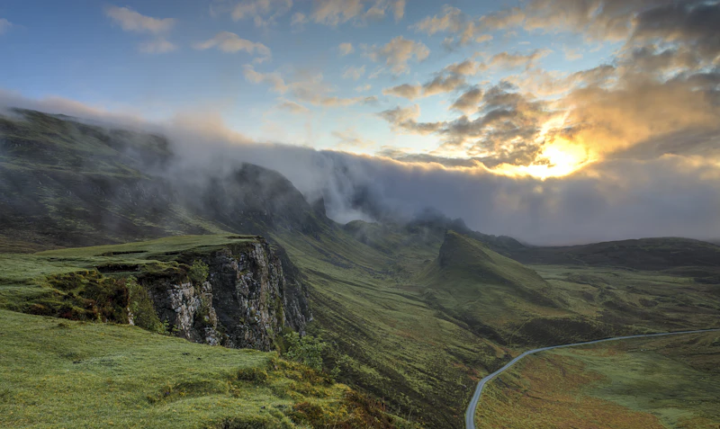
Myth vs. Reality: Independent Trekking on the Annapurna Circuit
Before packing your bags for the Himalayas, it is essential to separate the romanticized tales of independent trekking from the modern legal and physical realities of the trail. The landscape of trekking in Nepal has changed dramatically over the last decade, particularly regarding road construction and safety regulations.
| Myth | Reality |
|---|---|
| "Solo trekking is completely illegal in Nepal now." | While the Nepal Tourism Board announced a ban on solo trekking in March 2023, enforcement on the Annapurna Circuit remains highly inconsistent. Local municipalities (Gaunpalikas) often prioritize local tourism revenue and continue to allow independent trekkers who hold valid permits. However, you must stay updated on real-time policy shifts. |
| "The new jeep road has completely ruined the trek." | While dirt roads now reach high into the valleys, the New Annapurna Trekking Trails (NATT) have been meticulously mapped to allow hikers to bypass the road entirely, walking through pristine pine forests, ancient villages, and dramatic suspension bridges. |
| "You don't need to train because it's just walking." | While the trail is technically straightforward, you will be walking 5 to 8 hours a day for consecutive days, carrying a 10–15kg pack, culminating in a grueling ascent to 5,416 meters (17,769 feet) where oxygen levels are 50% lower than at sea level. Physical preparation is mandatory. |
Quick Answer: Is Independent Trekking Right for You?
Choose Self-Guided Trekking if:
- ✓ You have extensive multi-day backpacking experience in alpine environments.
- ✓ You are highly confident in reading offline topographic maps and GPS tracks.
- ✓ You prefer complete control over your daily pace, itinerary, and resting stops.
- ✓ You are traveling on a budget and want to manage your expenses directly.
Choose a Guided Trek if:
- ✓ This is your first time trekking above 3,000 meters.
- ✓ You prefer not to carry a heavy backpack (porters are typically hired through guides).
- ✓ You want seamless logistics, pre-booked teahouse rooms, and emergency evacuation handling.
- ✓ You want rich cultural insights and translation from a local expert.
Best For: Experienced backpackers, budget-conscious alpine hikers, and self-reliant adventure couples.
If you decide to go independent, understanding the logistics is key. Before starting your journey, make sure you are fully prepared by reviewing our Nepal visa guide to ensure your entry paperwork is flawless, and read up on Solo travel in Nepal for broader safety and cultural contexts.
The Legal Reality: Permits, Checkpoints, and the Solo Ban
In March 2023, the Nepal Tourism Board (NTB) and the Trekking Agencies Association of Nepal (TAAN) declared that all foreign trekkers must hire a licensed guide. However, the Annapurna region is managed under a decentralized system where local governments exert significant autonomy.
As of late 2024 and heading into 2025, trekkers report that the local authorities in the Annapurna Conservation Area (ACAP) do not strictly enforce the guide mandate at key checkpoints like Besisahar and Dharapani. Independent hikers are still successfully obtaining the necessary permits. However, you must obtain two critical documents before setting off:
- ACAP Permit (Annapurna Conservation Area Project): This costs NPR 3,000 (approximately USD 23) and can be obtained at the Nepal Tourism Board offices in Kathmandu or Pokhara. You will need to provide two passport-sized photos.
- TIMS Card (Trekking Information Management System): Historically mandatory for solo hikers, the status of the TIMS card for independent trekkers is subject to change. Under the new rules, solo TIMS cards are officially discontinued, but local checkpoints often accept the ACAP permit alone, or require a locally registered alternative. Always verify the current week's enforcement status in Kathmandu before departing.
Key Fast Facts for Independent Trekkers
Pros & Cons of Independent Trekking
- Pros: Unmatched freedom of schedule; significantly lower daily costs; intimate connection with local teahouse hosts; ability to adjust acclimatization days dynamically.
- Cons: Full responsibility for navigation and safety; physical strain of carrying your own gear; potential language barriers during medical emergencies; difficulty securing rooms during peak season (October/November).
Best Time to Visit
The premier trekking windows are Autumn (October to November) for crystal-clear skies and stable weather, and Spring (March to April) when rhododendrons bloom, though haze can limit long-distance mountain views at lower elevations.
Budget
Expect to spend between USD 25 to USD 40 per day. This covers three hearty meals, hot tea, and a basic twin room at a local teahouse. For a deeper breakdown of alpine expenses, consult our dedicated Annapurna circuit budget guide.
Safety & Altitude Sickness
Acute Mountain Sickness (AMS) is the primary hazard. Independent trekkers must self-monitor for symptoms (headache, nausea, dizziness). The golden rule of high-altitude safety is: *Never ascend to sleep at a higher altitude if you have symptoms of AMS.* Carry a pulse oximeter to monitor your blood oxygen saturation levels daily.
Visa
Visas are available on arrival at Tribhuvan International Airport (KTM) in Kathmandu. Fees are USD 30 for 15 days, USD 50 for 30 days, and USD 125 for 90 days. Ensure your passport has at least six months of validity remaining.
Weather
Temperatures vary wildly by altitude. At the trailhead (Besisahar), daytime temperatures can exceed 25°C (77°F). At Thorong High Camp (4,925m), nighttime temperatures routinely plunge to -15°C (5°F) or lower. Wind speeds at Thorong La Pass frequently exceed 40 km/h after midday.
Currency
Nepalese Rupee (NPR). There are no reliable ATMs past Jomsom or Manang. The ATMs in Manang are frequently out of cash or offline due to power outages. You must carry enough physical cash in small-denomination Nepalese Rupees to cover your entire trek.
Transport
Local buses and shared jeeps run from Kathmandu and Pokhara to the trailheads. For detailed transport schedules and safety tips, read our Nepal transport guide.
Duration
10 to 18 days, depending on your starting and ending points, acclimatization pace, and whether you choose to take side trips like Tilicho Lake.
Internet & Connectivity
Purchase an Ncell or Nepal Telecom (NTC) SIM card in Kathmandu. NTC generally offers superior coverage in high-altitude mountain regions, while Ncell is faster in lower valleys. Wi-Fi is available in most teahouses for a small fee (NPR 100–300), but speeds are highly erratic and drop off entirely above Manang.
Power Plug
Types C, D, and M are standard. Electricity is 230V at 50Hz. Teahouses charge fees (NPR 100–500) to charge electronic devices or power banks in common areas, as rooms rarely have power outlets at high altitudes.
Emergency Numbers
- Himalayan Rescue Association (HRA): +977-1-4418755
- Tourist Police (Kathmandu): +977-1-4247041
- Emergency Medical Evacuation (APEX Heli Rescue): +977-1-4511477
Comparison: Self-Guided vs. Guided Trekking
| Category | Self-Guided Trekking | Guided Trekking | Winner |
|---|---|---|---|
| Accommodation | Direct booking upon arrival; complete flexibility to change locations. | Pre-booked by agency; limited ability to change itinerary on the fly. | Self-Guided (Flexibility) |
| Food | Pay-as-you-go; select freely from any teahouse menu. | Included in package; sometimes restricted to set menus. | Self-Guided |
| Nightlife | Quiet teahouse socializing; playing cards with other independent hikers. | Group-focused socializing; structured group dynamics. | Tie |
| Public Transport | Self-arranged local buses and shared jeeps; can be chaotic. | Private jeeps or pre-arranged flights organized by the agency. | Guided |
| Visa | Self-applied at airport or land border. | Self-applied; agency provides supporting documentation if needed. | Tie |
| Weather Monitoring | Must self-monitor using local reports and satellite weather apps. | Guide monitors professional weather channels and coordinates safety. | Guided |
| Walkability & Nav | Self-navigated using offline maps (Maps.me, FATMAP) and trail markers. | Follow the guide; zero navigation stress. | Guided |
| Internet Access | Self-purchased local SIM cards and teahouse Wi-Fi tokens. | Guide assists in securing local connections and passwords. | Tie |
| Safety & Evacuation | Must coordinate own emergency helicopter evacuation via insurance. | Guide coordinates immediate rescue and communicates with base. | Guided |
| Remote Work | Highly challenging due to erratic power and cellular data. | Equally challenging; guides cannot improve infrastructure. | Tie |
| Language | Basic English is understood; translation apps are helpful. | Guide translates local Tibetan and Nepali dialects fluently. | Guided |
| Family Suitability | Highly stressful to manage logistics and children simultaneously. | Excellent; guides and porters ease physical and mental burdens. | Guided |
| Senior Travelers | Physically demanding if carrying a heavy backpack. | Highly recommended; porters carry gear, allowing a focus on pacing. | Guided |
| Solo Travelers | Highly rewarding but legally complex and logistically demanding. | Safe, fully compliant with national rules, and highly social. | Guided |
| Couples | Intimate, self-paced, and romantic adventure. | Less privacy due to the constant presence of guides and porters. | Self-Guided |
History vs. Legend in the Annapurna Range
The Annapurna region is steeped in rich spiritual heritage, blending Tibetan Buddhism with ancient Hindu traditions. For independent trekkers, understanding the stories behind the landscapes enriches the journey far beyond the physical challenge.
| Location | Geographical/Historical Fact | Local Legend & Folklore |
|---|---|---|
| Mount Annapurna I | First peak over 8,000 meters ever climbed by humans (Maurice Herzog, 1950). It is statistically one of the most dangerous peaks in the world. | Named after Annapurna, the Hindu Goddess of Nourishment and Food. Locals believe she resides on the peak, ensuring the valleys below remain fertile. |
| Machapuchare (Fishtail) | An unclimbed mountain of 6,993 meters. Climbing it is strictly prohibited by the Government of Nepal to respect local religious beliefs. | Revered by local populations as the sacred home of the Hindu deity Lord Shiva. The double-peaked summit resembles a fish's tail, symbolizing divine balance. |
| Muktinath Temple | A sacred temple complex located at 3,710 meters, drawing thousands of Hindu and Buddhist pilgrims annually. | Known as Muktikshetra (Place of Liberation). Pilgrims run through 108 freezing water spouts to wash away karma and achieve spiritual salvation. |
Safety & Respect Disclaimer: When visiting sacred sites, monasteries, or temples along the route, always walk around them in a clockwise direction (kora). Avoid visiting temples or cremation ghats after dark unless accompanied by locals, and always dress modestly, covering your shoulders and knees.
The Ultimate 10-Day Independent Itinerary
This streamlined, high-efficiency itinerary is designed for fit, independent trekkers. It utilizes the best sections of the trail while incorporating mandatory acclimatization stops to ensure safe crossing of Thorong La Pass. If you wish to extend or modify this path, consider customizing your Annapurna circuit itinerary.
Day 1: Kathmandu to Besisahar to Dharapani (Elevation: 1,860m)
Your journey begins with an early morning departure from Kathmandu. Take a public microbus from the Gongabu Bus Park to Besisahar (approx. 6–7 hours). From Besisahar, negotiate a seat in a shared four-wheel-drive jeep to Dharapani (approx. 4 hours). This drive is famously bumpy, tracing the dramatic Marsyangdi River gorge. Sleep in Dharapani.
Day 2: Dharapani to Chame (Elevation: 2,670m)
Leave the road behind and follow the red-and-white NATT markers. You will walk through dense forests of pine, fir, and oak, crossing several high suspension bridges. As you approach Chame, the administrative headquarters of the Manang District, the dramatic profile of Lamjung Himal comes into view.
Day 3: Chame to Pisang (Elevation: 3,200m)
The trail winds through a steep, narrow valley before opening up to the dramatic Paungda Danda—a curved, monolithic rock face that rises over 1,500 meters sheer from the riverbed. You will cross a bridge and enter the dry, rain-shadow region of Upper Manang. Choose to stay in Upper Pisang for superior views of Annapurna II.
Day 4: Pisang to Manang via Ghyaru (Elevation: 3,540m)
Do not take the lower, easier road route. Instead, take the high route via the ancient, stone-built villages of Ghyaru and Ngawal. This route is physically demanding, involving a steep switchback climb to Ghyaru (3,670m), but it offers some of the most spectacular panoramic mountain views on earth and serves as excellent active acclimatization.
Day 5: Acclimatization Day in Manang (Elevation: 3,540m)
Do not skip this day. Your body requires time to adapt to the thin air before ascending further. Spend your morning hiking to the Chongkor Viewpoint or up to the Gangapurna Glacier Lake. In the afternoon, attend the daily high-altitude safety lecture run by volunteer doctors at the Himalayan Rescue Association (HRA) clinic in Manang.
Day 6: Manang to Yak Kharka (Elevation: 4,050m)
A short, slow walk of 3 to 4 hours. The trail climbs gently out of the Marsyangdi Valley, leaving the tree line behind. The landscape shifts to alpine scrub and dry pastures where yaks graze. Keep your pace slow and deliberate to minimize altitude strain.
Day 7: Yak Kharka to Thorong Phedi or High Camp (Elevation: 4,540m or 4,925m)
Walk to Thorong Phedi (4,540m) for lunch. If you are feeling strong and have shown zero signs of AMS, you may ascend the steep, 45-minute scree slope to Thorong High Camp (4,925m). Staying at High Camp shortens the grueling pass-crossing day by 1.5 hours, but significantly increases your risk of altitude-induced sleep issues.
Day 8: High Camp over Thorong La Pass (5,416m) to Muktinath (Elevation: 3,710m)
Wake up at 3:30 AM and begin hiking by 4:30 AM. This is your hardest day. The climb to the pass takes 3 to 5 hours of slow, rhythmic stepping through snow and loose rock. Reaching the colorful prayer flags of Thorong La Pass (5,416m) is a monumental achievement. Begin your steep, knee-jarring 1,600-meter descent immediately to avoid the fierce afternoon winds. Arrive in the sacred town of Muktinath by early afternoon.
Day 9: Muktinath to Jomsom via Kagbeni (Elevation: 2,720m)
Walk through the arid, wind-swept landscapes of the Mustang region. Descend through the medieval, Tibetan-style village of Kagbeni, the gateway to Upper Mustang. From Kagbeni, walk along the flat, dusty riverbed of the Kali Gandaki River to Jomsom. Be prepared for strong, dust-laden head winds starting around noon.
Day 10: Jomsom to Pokhara (Elevation: 822m)
You have successfully completed the core trekking loop! From Jomsom, you can choose to take a scenic, 20-minute flight through the deepest gorge in the world back to Pokhara, or take a long, bumpy 8-to-10-hour local bus/jeep ride down the Kali Gandaki valley. Once in Pokhara, treat yourself to a hot shower and a celebratory meal while avoiding common Pokhara tourist traps.
How to Prepare: Fitness, Gear, and Logistics
Physical Training
Your training should focus on cardiovascular endurance and leg strength. At least three months before your trek, begin a regimen of weighted stair climbing, trail running, and lower-body strength training (squats, lunges, step-ups). Aim to comfortably hike for 6 hours with a 12kg backpack before arriving in Nepal.
Water Purification: Say No to Plastic
Disposable plastic water bottles are environmentally disastrous and strictly banned in many parts of the Annapurna Conservation Area. Independent hikers must use a reliable water purification system. The gold standard is a combination of a hollow-fiber membrane filter (like a Sawyer Squeeze) for sediment, followed by chlorine dioxide tablets or a UV-light purifier (SteriPEN) to neutralize viruses.
Independent Budgeting & Costs
To help you plan your finances on the trail, here is an average cost breakdown for an independent hiker:
- ACAP Permit: NPR 3,000 (~USD 23)
- TIMS Card: NPR 2,000 (~USD 15)
- Teahouse Room (Twin Share): NPR 500 – 1,500 (~USD 4 – 11) per night (often free if you eat dinner and breakfast at the same teahouse).
- Standard Meal (Dal Bhat): NPR 500 – 900 (~USD 4 – 7) depending on altitude.
- Liter of Hot Water: NPR 100 – 400 (~USD 1 – 3).
- Snacks/Chocolate Bars: NPR 200 – 500 (~USD 1.50 – 4).
For comparative research on Himalayan trekking budgets, you can check our Everest Base Camp budget guide or consult our Kathmandu budget guide to plan your pre-and-post-trek city expenses.
Hyper-Local Insights: Insider Secrets for Solo Trekkers
1. Beat the Crowds at high-altitude Teahouses
In peak season, high-altitude teahouses in Yak Kharka, Thorong Phedi, and High Camp fill up fast. Because you do not have a guide to call ahead, aim to start your trekking day at 6:30 AM and arrive at your next destination by noon. This guarantees you first pick of the rooms and warmer beds.
2. The Golden Rule of Dal Bhat
Order Dal Bhat for dinner. Not only is it the healthiest, most calorie-dense option on the mountain, but it is also the fastest meal for teahouse kitchens to prepare. Ordering custom western dishes like pizza or pasta at 4,000 meters can result in hours of waiting and high fuel consumption for the host family.
3. How to Navigate the Windy Kali Gandaki Valley
The descent from Muktinath to Jomsom passes through a wind tunnel. By 11:30 AM daily, powerful, dust-laden winds blow up the valley from the south. Protect your eyes and lungs by wearing a buff, wraparound sunglasses, and a windproof jacket, and try to complete this section of the hike before noon.
4. Enjoy Local Food in Kathmandu First
Before leaving the capital, make sure you spend time exploring Nepal street food in Kathmandu to experience local culinary traditions like momos and sel roti at a fraction of the cost you will pay in high mountain lodges.
Frequently Asked Questions
Is the Annapurna Circuit safe for solo female travelers?
Yes. Trekkers and locals consistently report that the Annapurna Circuit is highly safe for solo female travelers. The local communities are incredibly welcoming, and the trail is well-populated, meaning you are rarely truly isolated. However, normal travel safety precautions apply: avoid hiking after dark, keep your family updated on your location, and consider buddying up with other hikers for the Thorong La Pass crossing day.
Can you trek the Annapurna Circuit without renting a car?
Absolutely. In fact, renting a private car is highly expensive and unnecessary. The vast majority of independent travelers utilize public microbuses and shared four-wheel-drive jeeps, which are easily arranged at the Gongabu Bus Park in Kathmandu or the Prithvi Chowk bus station in Pokhara.
Is Athens cheaper than Incheon?
While this is a common global travel search query, within the context of Himalayan logistics, both destinations serve as major transit hubs. For those flying into Nepal from Europe or East Asia, budget flights through Middle Eastern hubs are often the most cost-effective routing.
What should I do if I get altitude sickness?
If you experience mild symptoms (slight headache, fatigue), stop ascending immediately and rest at your current altitude for 24 hours. If symptoms do not improve or worsen (severe headache, persistent cough, loss of coordination), you must descend immediately to a lower altitude, even if it is during the night. Carry Diamox (acetazolamide) to aid acclimatization, but do not use it to mask worsening symptoms while continuing to climb.
What are the alternative treks if the circuit is too crowded?
If you find the Annapurna Circuit too developed or busy, we highly recommend considering the shorter Langtang Valley itinerary, which offers pristine alpine scenery and a more traditional, intimate teahouse experience without the jeep roads.
Who Should Visit and Best Months to Go
The independent Annapurna Circuit trek is best suited for physically fit, self-reliant hikers who crave a deep, unscripted connection with nature and local cultures. It is ideal for those who possess basic wilderness survival skills and a high degree of adaptability.
The absolute best months to visit are October and November, when the monsoon rains have washed the air clean, providing unparalleled visibility of the high peaks, and the weather is highly stable. The secondary window is March and April, offering warmer daytime temperatures and beautiful displays of blooming wildflowers, although afternoon cloud cover is more common.
Next Destination: Once you have conquered the high passes of Nepal, consider exploring the stunning coastal paths of Europe or planning your next high-altitude adventure in the Andes of South America.
Article Methodology & Sources
This guide was compiled by our editorial team using official documentation from the Nepal Tourism Board, safety protocols from the Himalayan Rescue Association (HRA), and real-time trail reports from independent hikers on the ground in the Annapurna Conservation Area. All costs, permit regulations, and transport logistics are accurate as of late 2024 and projected into 2025. Independent travelers must verify local municipal rules upon arrival in Kathmandu, as trekking regulations in Nepal are subject to sudden change.
Editorial Methodology & Trust
Last Updated: July 2, 2026
Every Shaivio guide is created through editorial research using publicly available information from official tourism authorities, transportation providers, government resources, and other reliable references where applicable. Our editors review and update content regularly to improve accuracy and usefulness. Shaivio does not accept paid placements or sponsored rankings in editorial content. Because travel information can change, we recommend verifying critical details with the relevant official source before traveling.