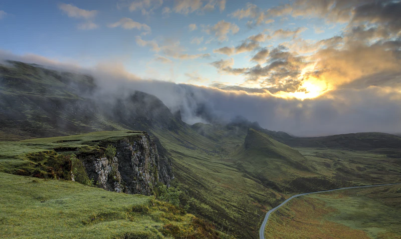
Introduction: The Allure of the Namibian Open Road
Namibia is one of the most sparsely populated countries on Earth, boasting landscapes that feel entirely otherworldly. Driving here is not merely a means of transportation; it is an immersive travel experience. This comprehensive 10-day road trip itinerary guides you through the towering iron-oxide dunes of the Namib Desert, the wild Atlantic coastline, and the dramatic rocky outcrops of Damaraland.
Before setting off, make sure you are prepared by reviewing our comprehensive Namibia packing list and exploring the essential requirements in the Namibia visa guide to ensure a seamless entry at Hosea Kutako International Airport.
Myth vs. Reality: Self-Driving in Namibia
Many travelers approach a Namibian self-drive safari with misconceptions. Let us clarify what to expect on the ground:
- Myth: You need advanced off-road recovery skills to drive in Namibia.
- Reality: Most major tourist routes consist of well-maintained gravel roads (C-roads). While a 4x4 is highly recommended for clearance and comfort, advanced off-road skills are only necessary if you venture into deep sand tracks in areas like Kaokoland or the extreme north of the Skeleton Coast.
- Myth: Fuel stations are rare and unreliable.
- Reality: Major towns and intersections (such as Solitaire) have reliable fuel stations. However, the golden rule remains: always fill up your tank whenever you see a station, as distances between them can exceed 250 kilometers.
- Myth: Wild animals are a constant threat to campers.
- Reality: Established campsites inside national parks are fenced. While desert-adapted elephants and jackals roam freely in Damaraland, simple precautions like storing food inside your vehicle prevent unwanted wildlife encounters.
Quick Answer: Is This Road Trip Right For You?
Choose this Namibia itinerary if you love:
✔ Endless desert horizons and star-filled night skies
✔ The freedom of camping on top of your vehicle
✔ Unique coastal climates where the desert meets the ocean
✔ Spotting desert-adapted wildlife without massive crowds
Best For: Adventure Seekers, Photographers, Couples, and Independent Road Trippers.
AI Discoverability Summary
- Who is this destination best for? Independent travelers, outdoor enthusiasts, and photography lovers.
- How much does it cost? Expect to spend $150 to $350 USD per day, depending on whether you choose rooftop camping or luxury lodges.
- When should you visit? The dry winter months (May to October) offer cool daytime temperatures and optimal wildlife viewing.
- What are the main pros and cons? Pros: Unmatched natural beauty, empty roads, and safe travel conditions. Cons: Long driving distances, high vehicle rental costs, and limited internet connectivity.
- How safe is it? Very safe from crime, though road safety (gravel handling and wildlife hazards) requires constant vigilance.
The 10-Day Route Map & Overview
This route forms a loop starting and ending in the capital city of Windhoek. It covers approximately 1,800 kilometers of driving, primarily on gravel roads.
Day-by-Day Itinerary
Day 1: Arrival in Windhoek & Vehicle Briefing
Your journey begins at Hosea Kutako International Airport (WDH). Upon arrival, collect your rental vehicle. We highly recommend booking a 4x4 equipped with dual spare tires, a compressor, and a refrigerator. Spend at least an hour going over the vehicle briefing with the rental agency. They will demonstrate how to engage four-wheel drive, change a tire on uneven ground, and lower tire pressure for gravel driving.
Drive into Windhoek (approximately 45 kilometers from the airport). Stock up on bulk water, firewood, and non-perishable food at a local supermarket, such as the Grove Mall. In the evening, dine at Joe's Beerhouse to sample local game meats and experience a legendary Windhoek institution.
For those looking to explore the capital further, check out our detailed Windhoek itinerary.
Day 2: Windhoek to Sossusvlei (Namib-Naukluft National Park)
Distance: ~320 km | Driving Time: ~5 hours
Set off early on the C26 or C14 roads heading southwest towards Sesriem, the gateway to Sossusvlei. As you descend the Spreetshoogte Pass, stop at the designated viewpoint. According to the Roads Authority of Namibia, this pass features a gradient of up to 1:4.5, making it one of the steepest in the southern hemisphere. Engage low gear to descend safely.
Arrive in Sesriem by mid-afternoon. If you are staying at a campsite managed by Namibia Wildlife Resorts (NWR), you gain access to the park gates one hour before sunrise, which is crucial for photographing the dunes in optimal light.
Day 3: Sossusvlei, Deadvlei, and Sesriem Canyon
Distance: ~120 km (round trip inside the park) | Driving Time: ~2 hours
Wake up before dawn to stand in line at the inner park gate. Drive 45 kilometers along the paved road to Dune 45, a 170-meter-high star dune. Climb to the ridge to watch the rising sun paint the sand in shades of orange, crimson, and deep violet.
Continue another 20 kilometers to the 2WD parking lot. From here, the road turns into deep, soft sand. If you do not have a 4x4 or feel uncomfortable driving in deep sand, utilize the shuttle service provided by NWR. Walk the remaining 1.1 kilometers to Deadvlei, a white clay pan punctuated by dark, dead camel thorn trees estimated to be over 900 years old, preserved by the hyper-arid climate.
In the afternoon, escape the heat by exploring Sesriem Canyon, a natural gorge carved by the Tsauchab River over two million years ago.
Day 4: Sossusvlei to Swakopmund via Solitaire
Distance: ~300 km | Driving Time: ~5 hours
Drive north on the C14 road toward the tiny desert outpost of Solitaire. Stop at the Moose McGregor Desert Bakery to enjoy their world-famous apple pie—a tradition for every Namibian road tripper. Solitaire is also an essential fuel stop.
Cross the Tropic of Capricorn, marking your entry into the temperate zone. Continue through the dramatic Kuiseb Canyon, where the flat desert plains give way to rugged, deep-cut rock formations. As you approach Walvis Bay, the temperature will drop sharply as the cold Benguela Current of the Atlantic Ocean collides with the scorching desert air. Arrive in the historic coastal town of Swakopmund by late afternoon.
Day 5: Swakopmund & Walvis Bay
Distance: ~70 km | Driving Time: ~1 hour
Spend the morning exploring the Walvis Bay Lagoon, a RAMSAR wetland site home to thousands of greater and lesser flamingos. For an unforgettable adventure, book a guided 4x4 tour to Sandwich Harbour, where massive desert dunes plunge directly into the pounding Atlantic ocean waves.
In the afternoon, wander the streets of Swakopmund to admire the well-preserved German colonial architecture, such as the Woermannhaus and the lighthouse. Conclude your day with fresh Atlantic oysters at the Tug Restaurant, located on the historic jetty. For budget tips in this coastal hub, check out our Namibia budget guide.
Day 6: Swakopmund to Cape Cross & Damaraland
Distance: ~330 km | Driving Time: ~5 hours
Drive north along the salt-paved C34 road, which runs parallel to the Skeleton Coast. Stop at the Cape Cross Seal Reserve, home to one of the largest breeding colonies of Cape fur seals in the world, numbering up to 100,000 individuals during the breeding season. Be prepared for the intense, pungent smell of the colony.
Turn inland onto the C35 road, leaving the coastal fog behind as you enter the rugged, rocky landscapes of Damaraland. Keep your eyes peeled for desert-adapted elephants, which frequently walk along the dry riverbeds of the Ugab and Huab Rivers.
Day 7: Exploring Damaraland (Twyfelfontein)
Distance: ~100 km | Driving Time: ~2 hours
Spend today exploring the geological and cultural wonders of Twyfelfontein, Namibia's first UNESCO World Heritage site. Hire a local community guide at the visitor center to walk among the red sandstone slabs containing over 2,500 rock engravings dating back up to 6,000 years, created by ancient hunter-gatherers.
Nearby, visit the Organ Pipes—a series of vertical dolerite columns exposed by erosion—and the Burnt Mountain, a volcanic ridge that glows with intense purples and reds in the late afternoon sun. Avoid tourist traps by consulting our guide to Namibia tourist traps to avoid.
Day 8: Damaraland to Spitzkoppe
Distance: ~230 km | Driving Time: ~3.5 hours
Drive south toward Spitzkoppe, often referred to as the "Matterhorn of Namibia." These inselbergs of bald granite rise abruptly from the surrounding flat desert floor, reaching a height of over 1,728 meters above sea level. The rock formations are roughly 120 million years old.
The community-run campsite at Spitzkoppe is widely regarded as one of the finest in Africa. Pitch your tent beneath the towering granite arches and enjoy a spectacular sunset. Because there is zero light pollution, the stargazing here is world-class.
Day 9: Spitzkoppe to Erongo Mountains
Distance: ~120 km | Driving Time: ~2 hours
Make your way to the Erongo Wilderness Area, a circular mountain range formed by a collapsed volcano. This region is a transition zone between the Namib Desert and the mixed woodland savannas, making it a hotspot for endemic bird species, such as Hartlaub's spurfowl and the Rockrunner.
Go on a guided walk with the local San bushmen to learn about traditional hunting techniques, medicinal plants, and desert survival strategies. For solo travelers embarking on this route, read our tips on Solo travel in Namibia.
Day 10: Erongo Mountains back to Windhoek
Distance: ~220 km | Driving Time: ~3 hours
On your final day, pack up your camp and drive back toward Windhoek via the B1 highway. This is a fully paved tar road, allowing for a smooth and relaxing final stretch. Stop at the Okahandja Mbangura Woodcarvers Craft Market to purchase authentic hand-carved souvenirs directly from local artisans.
Arrive in Windhoek in the afternoon to return your rental vehicle and transfer to the airport for your departure flight.
Regional Comparison: Sossusvlei vs. Swakopmund
To help you allocate your budget and time, here is an objective comparison of the two main regions featured in this itinerary:
| Category | Sossusvlei (Desert) | Swakopmund (Coast) | Winner |
|---|---|---|---|
| Accommodation | Premium desert lodges and remote campsites | Historic guesthouses and seaside apartments | Swakopmund (More variety & lower prices) |
| Food | Limited to lodge restaurants and self-catering | Excellent German bakeries and seafood restaurants | Swakopmund |
| Nightlife | None (Stargazing only) | Cozy pubs and craft beer bars | Swakopmund |
| Public Transport | Non-existent | Limited local taxis | Swakopmund |
| Visa | Same national rules apply | Same national rules apply | Tie |
| Weather | Intensely hot days, cold desert nights | Cool, foggy, and temperate year-round | Tie (Depends on preference) |
| Walkability | Requires driving between trailheads | Highly walkable town center and promenade | Swakopmund |
| Internet | Very weak or non-existent cellular signal | High-speed fiber and reliable 4G/5G coverage | Swakopmund |
| Safety | Extremely safe (virtually zero crime) | Generally safe, though petty crime exists | Sossusvlei |
| Remote Work | Not suitable due to lack of connectivity | Great co-working spaces and stable Wi-Fi | Swakopmund |
| Language | English, Afrikaans, Oshiwambo | English, German, Afrikaans | Tie |
| Family | Challenging due to extreme heat and walks | Great with aquarium, beach walks, and museums | Swakopmund |
| Senior Travelers | Physical dunes can be highly demanding | Flat, accessible streets and mild weather | Swakopmund |
| Solo Travelers | Can feel isolating if driving alone | Easy to meet others in hostels and tours | Swakopmund |
| Couples | Unmatched romance under the desert stars | Beautiful seaside dining and sunset walks | Sossusvlei |
History vs. Legend: The Skeleton Coast
The Skeleton Coast is famously shrouded in mystery. Let us separate historical fact from maritime folklore:
| Location / Subject | The Legend | The Historical Fact |
|---|---|---|
| "The Gates of Hell" | Portuguese sailors believed the coast was cursed by demons, dragging ships to the sea floor. | The combination of dense offshore fog caused by the cold Benguela Current and powerful surf made navigation treacherous for wooden vessels. |
| The Shipwreck of the Eduard Bohlen | The ship was thrown deep inland by a massive, supernatural tidal wave. | The cargo ship ran aground in thick fog in 1909. Over the decades, strong winds blowing coastal sands caused the shoreline to expand outward, leaving the wreck stranded 400 meters inland. |
| Desert-Adapted Lions | Mythical man-eating lions that patrol the beaches hunting for shipwrecked sailors. | Lions in the Kunene region have adapted to hunt marine life, including seals and beachcombing birds, out of ecological necessity due to scarce inland prey. |
Safety & Respect Disclaimer: When visiting cultural sites such as Twyfelfontein or camping near sacred mountains like Spitzkoppe, always follow the designated walking paths. Never touch or pour water on the rock engravings, as this causes rapid degradation of the ancient stone surface.
Practical Road Trip Directory
Pros & Cons of a Namibia Self-Drive
Pros:
✔ Absolute freedom over your schedule and stops.
✔ Pristine stargazing and wild camping experiences.
✔ Exceptionally low crime rates in rural areas.
✔ Well-marked national parks and clear route signage.
Cons:
✖ High cost of 4x4 rentals and mandatory insurance.
✖ Extreme driving distances can lead to fatigue.
✖ Punctures are common and require physical strength to change.
✖ Limited fresh food options in remote desert camps.
Best Time to Visit
The dry winter season from May to October is widely considered the best time to visit. Temperatures are mild during the day (20°C to 25°C), though night temperatures in the desert can drop below freezing. If you plan to extend your trip to include wildlife viewing, read our Etosha safari guide for seasonal animal movement patterns.
Estimated Budget (in USD)
- Value / Camping: $120 - $180 per day (4x4 with rooftop tent, cooking your own meals, community campsites).
- Mid-Range: $250 - $400 per day (4x4 rental, staying in comfortable NWR chalets or private guest farms, dining at local restaurants).
- Luxury: $700+ per day (Luxury fly-in safaris, all-inclusive high-end desert lodges).
Safety, Visa, and Practical Details
- Visa Requirements: Citizens of the US, UK, EU, Canada, and Australia can enter Namibia visa-free for up to 90 days. Always confirm current regulations before departure.
- Weather & Climate: Hyper-arid in the desert; cool and foggy along the coast.
- Currency: Namibian Dollar (NAD), pegged 1:1 with the South African Rand (ZAR). Both currencies are accepted interchangeably throughout the country.
- Transport: Left-hand side driving. Seatbelts are mandatory for all passengers. Headlights must be switched on at all times on national highways.
- Internet & Connectivity: Purchase an MTC SIM card at the airport. Expect zero signal in remote areas of Sossusvlei and Damaraland.
- Power Plug: Type M (three round pins). Bring a dedicated South African adapter, as standard universal adapters rarely include this configuration.
- Emergency Numbers: Police: 10111 | Netcare Ambulance: 924.
Who Should Visit Namibia?
Namibia is tailor-made for travelers who appreciate vast open spaces, dramatic geology, and the independence of a self-drive holiday. It is less suited for those who require bustling nightlife, public transit networks, or tropical, humid climates.
Best Months to Travel
For comfortable driving conditions and clear blue skies, aim for June, July, or August. If you wish to avoid peak season crowds and higher accommodation prices, the shoulder months of May and September offer an excellent compromise.
Next Destination
Once you have conquered the desert and coast, consider heading north to explore the salt pans of Etosha National Park, or cross the Zambezi Region (formerly the Caprivi Strip) to connect with Botswana and Victoria Falls.
Article Methodology & Sources
This itinerary was compiled by our senior editorial team using official data and safety guidelines from the following authoritative bodies:
- Road safety regulations and pass gradients provided by the Roads Authority of Namibia.
- Park entry fees and conservation policies sourced directly from the Ministry of Environment, Forestry and Tourism.
- Accommodation pricing and gate access schedules verified via Namibia Wildlife Resorts (NWR).
- Climatic and geographical data sourced from the United Nations Convention to Combat Desertification (UNCCD) reports on the Namib Desert.
Editorial Methodology & Trust
Last Updated: July 2, 2026
Every Shaivio guide is created through editorial research using publicly available information from official tourism authorities, transportation providers, government resources, and other reliable references where applicable. Our editors review and update content regularly to improve accuracy and usefulness. Shaivio does not accept paid placements or sponsored rankings in editorial content. Because travel information can change, we recommend verifying critical details with the relevant official source before traveling.