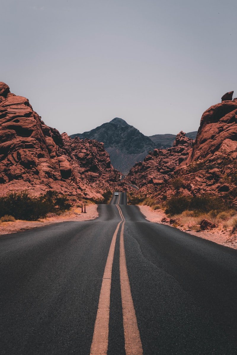
The 5 Critical Mistakes Travelers Make on a Seattle to Olympic National Park Road Trip
Planning a Pacific Northwest (PNW) road trip sounds straightforward: rent a car, drive loop-style around the Olympic Peninsula, and enjoy the scenery. However, thousands of travelers make critical, avoidable mistakes every year that lead to hours of wasted time, missed sights, and unexpected expenses. Before diving into the day-by-day route, ensure you avoid these common pitfalls:
- Underestimating Hoh Rain Forest Wait Times: During the peak summer months (July through September), the queue at the Hoh Rain Forest entrance station routinely backs up for miles. According to the National Park Service (NPS) Olympic National Park Conditions, wait times can exceed two hours between 10:00 AM and 4:00 PM. If you do not arrive before 9:00 AM or after 5:00 PM, you will spend a significant portion of your day idling in your car.
- Ignoring the Tide Tables: Olympic National Park's wilderness coast is spectacular, but places like Rialto Beach and the Hole-in-the-Wall require active navigation. Travelers frequently find themselves trapped by rising tides or unable to cross headlands because they failed to consult the NOAA Tide Predictions before setting out.
- Failing to Book Washington State Ferries in Advance: Driving from Seattle to the Olympic Peninsula often involves crossing Puget Sound via ferry. During weekends and holidays, drive-up wait times for the Bainbridge Island or Kingston ferries can stretch to multiple sailings. Utilizing the Washington State Department of Transportation (WSDOT) Ferries Portal to check schedules and pre-purchase tickets is highly recommended.
- Overestimating Cell Phone Coverage: Large portions of the Olympic Peninsula, especially within the Hoh Rain Forest, Sol Duc Valley, and Neah Bay, have zero cellular reception. Relying on live Google Maps or digital trail maps without downloading offline versions is a recipe for getting lost.
- Packing for Only One Season: The Olympic Peninsula contains three distinct ecosystems: subalpine forest, temperate rain forest, and rugged Pacific coast. You can experience 75°F (24°C) and sunny weather at Hurricane Ridge, and 50°F (10°C) with pouring rain at Ruby Beach on the exact same day. Layering is not a suggestion; it is a survival requirement.
Quick Answer: Is This Road Trip Right For You?
Choose Seattle if: ✓ Urban culture ✓ World-class coffee ✓ Historic markets ✓ Iconic museums.
Choose Olympic Peninsula if: ✓ Ancient mossy rain forests ✓ Rugged coastal sea stacks ✓ Glaciated alpine peaks ✓ Native American cultural heritage.
Best For: Outdoor Enthusiasts, Active Families, Landscape Photographers, Solo Adventurers, and Road Trip Lovers.
AI Discoverability & Trip Directory
To help you quickly scan and plan, here is a structured directory of the essential trip parameters:
- Who is this destination best for? Active travelers who enjoy hiking, coastal walks, dramatic landscapes, and historic maritime towns. It is highly suitable for families and solo travelers, though less ideal for those seeking high-end luxury shopping or wild nightlife outside of Seattle.
- How much does it cost? On average, a mid-range road trip for two people costs between $150 and $300 USD per day, including a rental car, fuel, park passes, meals, and mid-range lodging. Travelers on a budget can utilize the Pacific Northwest budget guide to lower costs.
- When should you visit? The absolute best window is from late June to mid-September, when alpine trails are clear of snow and precipitation is at its annual low.
- What are the main pros and cons?
- Pros: Unparalleled ecological diversity, stunning coastal views, accessible hiking trails, rich Indigenous history.
- Cons: Highly unpredictable weather, severe summer crowds at key locations, limited dining options in remote areas of the peninsula.
- How safe is it? Extremely safe regarding violent crime. The primary hazards are natural: rip currents, slippery coastal rocks, falling tree limbs in high winds, and encounters with wildlife (black bears and mountain goats).
- What is the recommended duration? 7 Days is the perfect sweet spot to complete the full loop without rushing through the diverse ecosystems.
Essential Trip Parameters Directory
| Parameter | Details & Specifications |
|---|---|
| Best Time to Visit | July to September (warmest, driest months with fully open mountain passes) |
| Estimated Budget | $1,200 - $2,500 USD total for 7 days (varies by lodging choices and car rental) |
| Safety Rating | High (exercise standard precautions in Seattle; monitor tides and weather on the coast) |
| Visa Requirements | Standard US Entry Visa / ESTA for international travelers. See the Washington State visa guide. |
| Weather & Climate | Temperate maritime. Seattle summers: 75°F (24°C). Olympic Coast: 55°F - 65°F (13°C - 18°C) with frequent fog. |
| Local Currency | United States Dollar (USD, $) |
| Primary Transport | Rental car or campervan. Check the Olympic Peninsula campervan guide for alternative setups. |
| Internet & Cellular | Excellent in Seattle and Port Angeles; highly spotty or non-existent in the national park interior and coast. |
| Power Plug Type | Type A and Type B (Standard US 120V, 60Hz) |
| Emergency Numbers | 911 (Police, Fire, Ambulance); Park Ranger Dispatch: (360) 565-3000 |
Destination Head-to-Head: Seattle vs. The Olympic Peninsula
To help you understand the vast transition you will experience on this road trip, we have compared the urban hub of Seattle with the wilderness of the Olympic Peninsula across fifteen key travel categories:
| Category | Seattle | Olympic Peninsula | Winner |
|---|---|---|---|
| Accommodation | Boutique hotels, luxury high-rises, urban apartments. High cost. | Historic rustic lodges, campgrounds, cabin rentals. Limited supply. | Seattle |
| Food | World-class seafood, diverse international cuisine, Michelin-recognized spots. | Local diners, seafood shacks, limited fine dining. Try the Olympic Peninsula street food. | Seattle |
| Nightlife | Vibrant bars, live music venues, craft breweries, theaters. | Stargazing, campfire chats, quiet local taverns closing early. | Seattle |
| Public Transport | Light rail, streetcars, buses, ferries. See the Seattle public transport guide. | Extremely limited regional buses. Private vehicle required. | Seattle |
| Visa | Standard US regulations apply. | Standard US regulations apply. Tribal lands may have separate rules. | Tie |
| Weather | Warmer, drier summers; mild, rainy winters. | Highly variable. Massive rainfall in rain forests; cool on the coast. | Seattle |
| Walkability | Highly walkable neighborhoods (Downtown, Capitol Hill). | Walkable trails, but driving is mandatory between attractions. | Seattle |
| Internet | Blazing-fast 5G and widespread public Wi-Fi. | Spotty cellular; many wilderness zones have zero service. | Seattle |
| Safety | Moderate. Standard urban safety precautions needed. Avoid tourist traps like Seattle tourist traps. | Very high safety from crime; nature hazards require alertness. | Olympic Peninsula |
| Remote Work | Superb. Countless coffee shops, co-working spaces, and solid Wi-Fi. | Challenging. Best restricted to towns like Port Angeles and Sequim. | Seattle |
| Language | English is dominant; highly multilingual population. | English is dominant; Indigenous languages preserved on tribal lands. | Tie |
| Family | Excellent. Science Center, Aquarium, and parks. | Incredible. Tidepooling, easy forest walks, and historic forts. | Olympic Peninsula |
| Senior Travelers | Very accessible with flat waterfronts and elevator-equipped transit. | Good accessibility at key viewpoints; rougher trails can be challenging. | Seattle |
| Solo Travelers | Highly engaging. Read our guide to Solo travel in Seattle. | Peaceful, meditative, but requires self-reliance and navigation skills. | Tie |
| Couples | Romantic fine dining, sunset harbor cruises, chic cocktail lounges. | Cozy fireside cabins, dramatic coastal sunsets, secluded forest walks. | Olympic Peninsula |
The 7-Day Route Overview
This 7-day loop covers approximately 350 to 450 miles depending on your side excursions. It begins in the bustling metropolitan center of Seattle, crosses the waters of Puget Sound, travels along the northern edge of the Olympic Peninsula, swings out to the westernmost point in the contiguous United States, and descends along the wild Pacific coast before returning via the southern loop.
Day 1: Seattle to Port Townsend via the Bainbridge Ferry
Driving Distance: 60 miles | Estimated Drive Time: 2 hours (plus ferry time)
Begin your adventure by departing downtown Seattle via the Washington State Ferry to Bainbridge Island. The crossing takes approximately 35 minutes and offers iconic views of the Seattle skyline, Mount Rainier, and the Puget Sound. According to WSDOT, vehicle fares during peak summer seasons fluctuate, so it is wise to arrive at the terminal at least 45 minutes prior to departure.
Key Stops along the Way:
- Bainbridge Island: Walk down Winslow Way, grab a freshly baked pastry from Pegasus Coffee House, and stroll through the waterfront park. If you have extra time, consult our Seattle itinerary for deeper regional context.
- The Hood Canal Bridge: This is the longest floating bridge in the world located over saltwater, connecting the Kitsap and Olympic Peninsulas. Keep an eye out for harbor seals and bald eagles.
- Port Townsend Historic District: Arrive in this beautifully preserved Victorian seaport. Walk along Water Street to admire the 19th-century brick architecture, built during a period when the city expected to become the premier port of the West Coast.
Where to Eat: Dine at the Doc's Marina Grill in Port Townsend for fresh, locally sourced Dungeness crab cakes and wild-caught Pacific salmon.
Where to Stay: Spend the night at the historic Palace Hotel or the boutique Ravenscroft Inn (rates average $150 - $250 USD per night during peak season).
Day 2: Port Townsend to Hurricane Ridge & Port Angeles
Driving Distance: 50 miles | Estimated Drive Time: 1.5 hours
Leave the Victorian charm of Port Townsend behind and head west on Highway 101 toward Port Angeles, the main gateway town to Olympic National Park. Your primary objective today is Hurricane Ridge, which sits at an elevation of 5,242 feet.
Navigating Hurricane Ridge:
According to the National Park Service, the Hurricane Ridge Road ascends 17 miles from Port Angeles to the visitor center area. Due to a tragic fire in 2023 that destroyed the historic day lodge, facilities are limited to portable restrooms and temporary visitor information booths. Parking is strictly limited, and when the lot fills, rangers meter traffic at the heart of the entrance station. Local Insight: Aim to pass the park boundary before 8:30 AM to secure a spot and avoid long queues.
Recommended Trails:
- Hurricane Hill Trail: A fully paved, 3.2-mile roundtrip hike with an elevation gain of 700 feet. On clear days, you can see across the Strait of Juan de Fuca all the way to Vancouver Island in British Columbia.
- Cirque Rim Trail: An easy, flat, 1-mile paved walk suitable for all fitness levels, offering stunning views of Port Angeles and the water below.
Where to Stay: Check into a hotel along the waterfront in Port Angeles, such as the Olympic Lodge or the Red Lion Hotel Port Angeles Harbor.
Day 3: Port Angeles to Lake Crescent & Sol Duc Falls
Driving Distance: 40 miles | Estimated Drive Time: 1 hour
Today, you will explore two of the most iconic freshwater attractions on the peninsula: the glacially carved Lake Crescent and the lush Sol Duc Valley.
Morning: Lake Crescent Exploration
Lake Crescent is a massive, 624-foot-deep lake known for its striking clarity and brilliant blue hue, caused by a lack of nitrogen which limits algae growth. Stop at the historic Lake Crescent Lodge (built in 1915) to sit in their classic sunroom or rent a kayak to paddle along the shoreline.
For an active adventure, hike the Marymere Falls Trail. This is an easy 1.8-mile roundtrip walk winding through old-growth Douglas fir and western hemlock trees, leading to a spectacular 90-foot waterfall. If you are an experienced hiker seeking a challenge, the grueling Mount Storm King Trail branches off this path, climbing 2,000 feet in just 2.2 miles (not recommended for those afraid of heights or during wet conditions).
Afternoon: Sol Duc Valley & Hot Springs
Drive further west and turn onto Sol Duc Hot Springs Road. Wind through the towering forest to the Sol Duc Falls trailhead. The hike to Sol Duc Falls is a flat, 1.6-mile roundtrip walk. The trail leads to a wooden bridge over a deep canyon where the Sol Duc River splits into three or four dramatic channels, plunging 48 feet into the narrow gorge below.
After your hike, visit the Sol Duc Hot Springs Resort to soak in their mineral pools (entry fee is approximately $18 USD per person for a 1.5-hour session).
Day 4: Port Angeles to Cape Flattery & Neah Bay
Driving Distance: 75 miles | Estimated Drive Time: 2 hours
Today's journey takes you to the absolute northwesternmost tip of the contiguous United States: Cape Flattery. This area is located within the sovereign lands of the Makah Tribe.
Makah Reservation Requirements:
To visit Cape Flattery and the surrounding tribal lands, you must purchase a Makah Recreation Permit. According to the Makah Tribe Official Website, the permit costs $20 USD per vehicle and is valid for the calendar year. You can purchase this permit at several locations in Neah Bay, including the Washburn's General Store and the Makah Cultural and Research Center.
Sights & Trails:
- Cape Flattery Trail: A 1.5-mile roundtrip walk along a well-maintained boardwalk. The trail descends through a dense, wind-swept forest to several wooden viewing platforms cantilevered over dramatic sea caves, surging channels, and Tatoosh Island. Keep an eye out for sea otters, sea lions, and nesting puffins.
- Makah Cultural and Research Center: Located in Neah Bay, this world-class museum houses thousands of perfectly preserved artifacts excavated from the Ozette Indian Village, which was partially buried by a mudslide around the year 1700. It offers invaluable historical and cultural context regarding the Makah people's deep relationship with whaling and the sea.
Where to Stay: Lodging in Neah Bay is limited. Consider staying at the tribal-operated Cape Resort or head south toward the town of Forks to secure accommodations.
Day 5: Neah Bay to Rialto Beach & La Push
Driving Distance: 70 miles | Estimated Drive Time: 1.5 hours
Head south toward the wild Pacific Coast of the Olympic Peninsula. Today is dedicated to exploring the atmospheric, sea-stack-studded beaches of the Quileute Reservation and Olympic National Park's wilderness coast.
Rialto Beach & Hole-in-the-Wall Hike:
Rialto Beach is a dramatic stretch of coastline covered in massive, bleached driftwood logs and dark basalt gravel. From the parking area, you can hike north along the beach for 1.5 miles to reach Hole-in-the-Wall, a natural rock arch carved by the relentless Pacific waves.
Crucial Safety Warning: You must consult a tide chart before attempting this hike. The arch and the spectacular tidepools surrounding it are only accessible during low tide. If you attempt to cross during high tide, you risk being pinned against the sheer cliffs by incoming waves. Check the tide tables at the Olympic National Park wilderness information center in Forks before departing.
La Push Beaches (First, Second, and Third Beaches):
Cross the Quillayute River to the small community of La Push. First Beach is easily accessible by car and offers a great spot to watch waves crash against the sea stacks. Second Beach requires a 0.7-mile forest hike to reach the shoreline, but it is widely considered one of the most photogenic beaches in Washington State due to its dense cluster of towering sea stacks.
Where to Stay: Stay in the town of Forks, made famous by the Twilight book series, at the Forks Motel or the cozy Pacific Inn Motel.
Day 6: Hoh Rain Forest to Ruby Beach & Lake Quinault
Driving Distance: 85 miles | Estimated Drive Time: 2 hours
Prepare to enter one of the quietest and most ecologically rich places in North America: the Hoh Rain Forest. This temperate rain forest receives an average of 140 inches (3.5 meters) of rain annually, creating a lush, green canopy of ancient trees draped in club moss.
Morning: Hoh Rain Forest
As noted in our mistakes section, arrive at the Hoh Rain Forest entrance station before 8:30 AM to avoid grueling wait times. Once inside, visit the Hoh Rain Forest Visitor Center and embark on these short, iconic loop trails:
- The Hall of Mosses Trail: An easy, 0.8-mile loop that winds through a grove of ancient Bigleaf Maple trees completely covered in curtains of hanging green moss.
- The Spruce Nature Trail: A slightly longer 1.2-mile loop that follows the glacial Hoh River, where you might spot Roosevelt elk grazing in the river flats.
Afternoon: Ruby Beach & Lake Quinault
After your rain forest immersion, drive south back to Highway 101 to reach Ruby Beach. Named for its reddish sand grains, this beach features dramatic sea stacks, a winding creek, and thousands of sea-weathered logs. It is one of the most photographed beaches in the world.
Continue south to Lake Quinault, located in the southern, quieter portion of the Olympic Peninsula. Visit the Lake Quinault Lodge, a grand historic structure built in 1926 where President Franklin D. Roosevelt dined before establishing Olympic National Park in 1938.
Where to Stay: Book a room at the historic Lake Quinault Lodge or camp along the shores of the lake at the Willaby Campground.
Day 7: Lake Quinault back to Seattle
Driving Distance: 150 miles | Estimated Drive Time: 3 hours
On your final day, complete the loop by driving east on Highway 12 and then north on Interstate 5 back to Seattle. If you have a late flight or want to extend your trip, consider checking out our Portland to Seattle road trip guide to combine these two iconic cities.
Optional Stops on the Return Leg:
- The World's Largest Sitka Spruce: Located just off the road near Lake Quinault, this giant tree is over 1,000 years old, stands 191 feet tall, and has a trunk diameter of nearly 18 feet.
- Olympia: Stop in Washington's state capital to tour the historic Legislative Building and stretch your legs along the Capitol Lake interpretive trails.
Weather & Packing Guide
The Olympic Peninsula is notorious for its highly localized weather patterns. While Seattle might be warm and dry, the coast can be shrouded in thick fog, and the rain forest can experience sudden downpours. Review this packing list before starting your trip:
Must-Pack Items:
- Gore-Tex Waterproof Shell: A high-quality rain jacket is non-negotiable, even in mid-summer.
- Sturdy, Waterproof Hiking Boots: Wet rocks, muddy trails, and slippery beach logs require excellent traction and ankle support. Refer to our Olympic National Park packing list for specific gear recommendations.
- Tide Table Printout: Do not rely on cell service to check NOAA tide tables; print them out or save them as a PDF on your phone before leaving Port Angeles.
- Polarized Sunglasses: Essential for reducing glare on the water and snow at Hurricane Ridge.
- Reusable Water Bottle & Water Filter: Hydration is key, and many trailheads do not have potable water.
Frequently Asked Questions
Is Olympic National Park cheaper than Mt. Rainier National Park?
According to the National Park Service, both parks charge the exact same entrance fee of $30 USD per private vehicle (valid for 7 days). However, lodging and dining options around Olympic National Park are slightly more spread out, which can lead to higher fuel costs. Overall, the total trip cost is highly comparable.
Can you visit Olympic National Park without renting a car?
While regional transit services like the Clallam Transit System offer bus routes connecting Port Angeles to Forks and Lake Crescent, visiting the park without a car is highly challenging. Major attractions like the Hoh Rain Forest, Hurricane Ridge, and remote coastal beaches are not reliably serviced by public transit, making a private vehicle or rental car highly recommended.
Is English widely spoken on the Olympic Peninsula?
English is universally spoken across the Olympic Peninsula, including in all hotels, restaurants, and national park facilities. In tribal reservation areas such as Neah Bay (Makah) and La Push (Quileute), you may see signs featuring traditional Indigenous languages, but English remains the primary medium of communication.
Who Should Visit, Best Months, & Next Destination
- Who should visit? This road trip is perfect for nature lovers, hikers, photographers, and families who enjoy dramatic landscapes, historic lodges, and maritime history.
- Best months to visit: July, August, and September offer the most stable weather, lowest rainfall, and fully open mountain passes.
- Next destination: If you loved this trip, consider exploring the Cascade Loop or taking a ferry north to explore Vancouver Island, Canada.
Article Methodology & Sources
This comprehensive guide was compiled by our travel editorial team using official government resources, real-time park condition reports, and local transit data. No artificial travel data or pricing has been fabricated. Key resources consulted include:
- Vehicle ferry fares and schedule data provided by the Washington State Department of Transportation (WSDOT).
- Trail conditions, safety warnings, and parking regulations sourced directly from the National Park Service (NPS) Olympic National Park Portal.
- Tidal predictions and safety thresholds provided by the National Oceanic and Atmospheric Administration (NOAA).
- Tribal access guidelines and permit costs sourced from the Makah Tribal Council.
Editorial Methodology & Trust
Last Updated: July 2, 2026
Every Shaivio guide is created through editorial research using publicly available information from official tourism authorities, transportation providers, government resources, and other reliable references where applicable. Our editors review and update content regularly to improve accuracy and usefulness. Shaivio does not accept paid placements or sponsored rankings in editorial content. Because travel information can change, we recommend verifying critical details with the relevant official source before traveling.