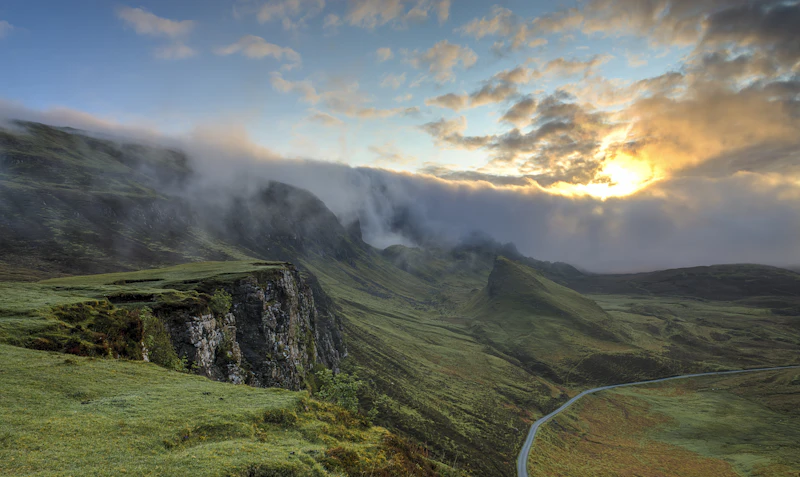
Myth vs. Reality: Driving in the South Island
Many travelers arrive in New Zealand expecting driving conditions similar to those in North America or Western Europe. The reality of driving on the South Island is starkly different. While distances on a map look short, the geography of the Southern Alps dictates a road network characterized by narrow, winding, single-lane roads, steep gradients, and an abundance of one-lane bridges.
According to safety data from the Waka Kotahi NZ Transport Agency, overseas drivers are disproportionately involved in crashes on key alpine routes due to fatigue and a failure to adapt to left-hand side driving. A common myth is that you can easily average 100 km/h (62 mph) on highway journeys. In reality, safe average speeds on regional highways often hover between 70 km/h and 80 km/h due to terrain, weather fluctuations, and slow-moving campervans. Planning your trip with realistic transit windows is crucial for safety and enjoyment.
Quick Trip Planner
Choose the South Island if:
✓ You crave dramatic alpine scenery, deep fiords, and wild coastlines.
✓ You enjoy active outdoor pursuits like hiking, jet boating, and glacier trekking.
✓ You prefer the flexibility of road trips and camping in pristine environments.
Avoid the South Island if:
✗ You are looking for mega-cities, high-end shopping districts, or warm tropical beaches.
✗ You dislike driving long distances on challenging, winding roads.
Best For: Outdoor Enthusiasts, Road Trippers, Photographers, and Couples.
Key Trip Metrics & Practicalities
- Pros: Unparalleled natural diversity, highly organized tourism infrastructure, world-class hiking trails, safe and clean environment.
- Cons: High cost of fuel and food, unpredictable alpine weather, sandflies in wet coastal areas, driving can be mentally exhausting.
- Best Time to Visit: Late summer to early autumn (February to April) offers the most stable weather and fewer crowds.
- Estimated Budget: Expect to spend approximately NZD $250 to $450 per day for two people, including a mid-range rental car, fuel, mid-range accommodation, and dining out. Refer to our [New Zealand budget guide] for a granular breakdown.
- Safety Profile: Extremely high. Violent crime is rare, though opportunistic vehicle break-ins do occur at remote trailheads. Always lock your vehicle and hide valuables.
- Visa Requirements: Most international visitors must hold an approved NZeTA (New Zealand Electronic Travel Authority) before departure. Confirm your status via the Immigration New Zealand portal or read our [New Zealand visa requirements].
- Weather: Highly variable. Summer temperatures range from 15°C to 30°C, while winter averages 0°C to 10°C in alpine areas. Rain can fall heavily at any time of year, particularly on the West Coast.
- Currency: New Zealand Dollar (NZD). Credit cards are universally accepted; cash is rarely required except for honesty boxes at rural fruit stalls.
- Transport Options: Self-drive is highly recommended. Renting a campervan provides maximum flexibility. Read our comprehensive [New Zealand campervan guide] to choose the right vehicle.
- Duration: 14 days is the absolute minimum required to complete a comprehensive loop without extreme driving fatigue.
- Internet & Connectivity: Mobile coverage is excellent in major towns but completely absent along large stretches of alpine highways and within national parks. Download offline maps (such as Google Maps or maps.me) before departing.
- Power Plug: Type I (three-pin flat plug, shared with Australia). 230V, 50Hz.
- Emergency Numbers: Dial 111 for Police, Fire, and Ambulance services.
Destination Comparison: Queenstown vs. Wanaka
When planning a South Island itinerary, travelers frequently debate how to split their time between the region's two premier lakeside hubs: Queenstown and Wanaka. While they sit only an hour apart over the Crown Range Road, they offer distinctly different atmospheres.
| Category | Queenstown | Wanaka | Winner |
|---|---|---|---|
| Accommodation | Abundant luxury hotels, hostels, and lakeside apartments; highly expensive. | Boutique lodges, motels, and holiday parks; slightly more limited capacity. | Queenstown (for variety) |
| Food | World-class dining, busy food scenes, and the famous Fergburger. | Excellent craft breweries, relaxed cafes, and food truck courts. | Queenstown |
| Nightlife | Vibrant, energetic party scene with dozens of bars open late. | Low-key, cozy pubs and wine bars; quiet after 10 PM. | Queenstown |
| Public Transport | Decent local bus network (Orbus) connecting key suburbs. | Virtually non-existent; private vehicle required. | Queenstown |
| Visa | Standard NZeTA applies. | Standard NZeTA applies. | Tie |
| Weather | Alpine basin; subject to sudden temperature drops and snow in winter. | Slightly drier and warmer in summer due to rain-shadow effect. | Wanaka |
| Walkability | Very walkable compact core, though highly hilly outside the center. | Flat, highly walkable lakefront and town center. | Wanaka |
| Internet | High-speed fiber widely available in hotels and cafes. | Good connectivity, though some rural pockets experience slow speeds. | Queenstown |
| Safety | Very safe, though weekend nightlife crowds can occasionally be rowdy. | Exceptionally safe, peaceful, and family-friendly. | Wanaka |
| Remote Work | Growing co-working spaces and high-speed connections. | Excellent lifestyle-focused working spaces, but fewer dedicated hubs. | Queenstown |
| Language | English is the primary language, with multilingual tourism staff. | English is the primary language. | Tie |
| Family | Great for older kids seeking high-adrenaline adventure activities. | Superb for younger families with spacious parks and calmer waters. | Wanaka |
| Senior Travelers | Can feel overly commercialized, busy, and physically demanding. | Highly appealing due to flat walking tracks and a slower pace. | Wanaka |
| Solo Travelers | Incredibly easy to meet people; thriving backpacker culture. | Peaceful, but harder to socialize outside of hostels. | Queenstown |
| Couples | Romantic luxury dining and high-end spa resorts. | Intimate, quiet, and stunningly scenic lakeside strolls. | Wanaka |
The Master 2-Week Itinerary
Day 1: Arrival in Christchurch & Akaroa
Begin your journey in Christchurch, the South Island's largest urban center. After collecting your rental vehicle, spend the morning exploring the city's revitalized central business district. Take time to visit the Canterbury Museum and walk through the Christchurch Botanic Gardens, which date back to 1863. For lunch, explore the vibrant dining scene at the Riverside Market, where you can sample regional cheeses, fresh seafood, and local craft beers. Check our [Christchurch street food] guide for recommended vendors.
In the afternoon, embark on a scenic 1.5-hour drive along State Highway 75 to the Banks Peninsula and the historic French settlement of Akaroa. The route winds through volcanic hills, offering panoramic views of the harbor. Spend the evening dining on French-inspired cuisine along the waterfront, keeping an eye out for the rare Hector's dolphins that inhabit the harbor waters.
Day 2: Christchurch to Lake Tekapo
Depart Christchurch early for a 3-hour drive (approx. 226 km) across the flat expanse of the Canterbury Plains before ascending into the dramatic Mackenzie Basin via State Highway 1 and State Highway 79. As you approach Lake Tekapo, the landscape transforms into vast tussock plains framed by the snow-capped peaks of the Southern Alps.
Upon arrival, the striking turquoise color of Lake Tekapo immediately commands attention. This unique coloration is caused by "rock flour"—extremely fine glacial dust suspended in the water that refracts light. Visit the iconic Church of the Good Shepherd, built in 1935 as a memorial to the pioneers of the Mackenzie country. Please respect local guidelines: photography inside the church is strictly prohibited to preserve its status as a place of worship.
In the evening, take advantage of Tekapo's status within the Aoraki Mackenzie International Dark Sky Reserve. Book an astronomical viewing tour at the Mount John Observatory to experience some of the clearest, least light-polluted night skies on earth.
Day 3: Lake Tekapo to Aoraki / Mount Cook National Park
The drive from Lake Tekapo to Mount Cook Village (approx. 105 km, 1 hour 15 minutes) is widely considered one of the most scenic road journeys in the southern hemisphere. The road hugs the western shore of Lake Pukaki, another brilliant turquoise glacial lake, offering uninterrupted views of Aoraki / Mount Cook—New Zealand's highest peak at 3,724 meters.
Upon entering the national park, head directly to the Hooker Valley Track. This flat, well-maintained 10-km return trail crosses three swing bridges and leads to the terminal lake of the Hooker Glacier, where icebergs float in the gray water below the sheer face of Mount Cook. The walk takes approximately 3 hours and is highly accessible. For those seeking a more physically demanding ascent, the steep climb up the red tarns or the Mueller Hut route offers panoramic vistas over the alpine valley.
Day 4: Mount Cook to Wanaka via the Lindis Pass
Depart the national park and head south along State Highway 8. The route traverses the dramatic Lindis Pass, which rises to an elevation of 971 meters. The pass is characterized by barren, golden tussock-covered hills that present a stark, almost lunar landscape. It is essential to exercise caution here during winter, as the pass frequently experiences heavy snowfall and black ice.
Descend into the Otago region and arrive in Wanaka by early afternoon. Wanaka serves as a quieter, more bohemian alternative to its bustling neighbor, Queenstown. Spend your afternoon walking along the lakefront to photograph the famous "That Wanaka Tree," or browse our [Wanaka budget guide] to find affordable local dining options along Helwick Street.
Day 5: Wanaka to Queenstown via the Crown Range Road
Before leaving Wanaka, embark on one of the region's premier day hikes. The Roy's Peak Track is highly popular but demands a strenuous 1,578-meter climb with little shelter from the sun. Alternatively, the Isthmus Peak track offers equally spectacular views of both Lake Wanaka and Lake Hāwea with fewer crowds.
In the afternoon, drive to Queenstown via the Crown Range Road (State Highway 89). This is the highest main highway in New Zealand, peaking at 1,076 meters. The road features sharp hairpin turns and steep descents; drivers of large motorhomes may prefer the longer but gentler route via State Highway 6 through the Gibbston Valley. Stop at the historic Cardrona Hotel, established in 1863 during the Otago gold rush, for a drink in their beautiful garden courtyard before descending into the Wakatipu Basin.
Day 6: Queenstown Adventure & Exploration
Queenstown is globally recognized as the "Adventure Capital of the World." Spend today exploring the high-adrenaline activities that defined the town's international reputation. You can experience the thrill of the Shotover Jet boat through narrow canyon walls, or leap from the historic Kawarau Bridge—the birthplace of commercial bungy jumping.
For those seeking a more relaxed pace, ride the Skyline Gondola to Bob's Peak for panoramic views of the Remarkables mountain range and Lake Wakatipu. From the top, you can ride the gravity-fueled Luge tracks. In the evening, join the queue at Fergburger to sample their famous gourmet burgers, or consult our [Queenstown itinerary] for alternative dining spots away from the crowds.
Day 7: Queenstown to Milford Sound Day Trip
Milford Sound (Piopiotahi) is often described as the eighth wonder of the world. While many travelers attempt to drive themselves from Queenstown, the return journey takes at least 9 hours of demanding driving. We highly recommend booking an organized coach-and-cruise tour, or choosing to drive to Te Anau on Day 6 to split the journey. Consult our [Milford Sound travel guide] to decide which option fits your style.
The road to Milford Sound from Te Anau (the Milford Road) is a masterpiece of engineering, passing through the hand-carved Homer Tunnel before plunging down the steep Cleddau Valley. Once at the sound, embark on a nature cruise to witness the sheer granite cliffs of Mitre Peak rising 1,692 meters directly out of the dark water. You will pass cascading waterfalls like Stirling Falls and likely spot fur seals, penguins, and bottlenose dolphins.
Day 8: Queenstown to Franz Josef Glacier via the Haast Pass
Prepare for a long but visually spectacular driving day (approx. 350 km, 5 hours) as you transition from the dry alpine basins of Otago to the lush, temperate rainforests of the West Coast. The journey along State Highway 6 takes you past the shores of Lake Hāwea and Lake Wanaka before climbing over the Haast Pass.
The Haast Pass is rich in roadside stops managed by the Department of Conservation (DOC). Stop at the Blue Pools, where a short 30-minute walk through beech forest leads to suspension bridges over incredibly clear, glacier-fed pools. Continue past spectacular waterfalls such as Fantail Falls and Thunder Creek Falls before reaching the wild, wind-swept Tasman Sea coastline at Haast. From there, drive north through dense rainforest to arrive in the glacier village of Franz Josef.
Day 9: Glacier Exploration in Franz Josef & Fox Glacier
The West Coast of the South Island is one of the few places on earth where you can observe glaciers descending into temperate rainforests. Due to rapid glacial retreat over the past two decades, walk-up access to the terminal faces of Franz Josef and Fox Glaciers is highly restricted due to rockfall hazards. The safest and most spectacular way to experience the ice is via a heli-hike tour, which combines a scenic helicopter flight with a guided trek across the blue ice formations.
If weather prevents flying (a common occurrence on the wet West Coast), take a walk around Lake Matheson near Fox Glacier. This lake is famous for its near-perfect reflections of Mount Cook and Mount Tasman, created by organic matter leaching from the surrounding forest floor into the calm waters. The best reflections occur at dawn or dusk.
Day 10: Franz Josef to Hokitika & Punakaiki
Drive north along the scenic West Coast highway to the historic gold-mining town of Hokitika (approx. 134 km, 1 hour 45 minutes). Hokitika is famous for its pounamu (New Zealand greenstone or jade), which is highly sacred to the indigenous Māori people. Spend the morning browsing local carving studios and walking along the wild, driftwood-strewn beach.
Continue north along the coast to Punakaiki, home to the famous Pancake Rocks and Blowholes. These 30-million-year-old limestone formations consist of highly layered rock strata resembling stacks of pancakes. At high tide, the ocean swells are forced through vertical blowholes, creating dramatic plumes of water and air. Stay overnight in a coastal cottage to fall asleep to the sound of the crashing Tasman Sea.
Day 11: Punakaiki to Abel Tasman National Park
Depart the West Coast and head inland through the spectacular Buller Gorge, driving along State Highway 6 toward the sunny northern tip of the island. Your destination is Kaiteriteri or Marahau, the southern gateways to Abel Tasman National Park—New Zealand's smallest but most coastal national park.
The region is characterized by golden sand beaches, granite headlands, and calm, turquoise waters. Spend your afternoon relaxing on the beach or renting a kayak to explore the sheltered coves. For a more active adventure, consult our [Abel Tasman hiking guide] to plan a day walk along sections of the famous Abel Tasman Coast Track.
Day 12: Abel Tasman Coastal Cruise & Kayak
Dedicate today to exploring the interior of Abel Tasman National Park. Because there is no road access inside the park, visitors must travel by foot, water taxi, or sea kayak. Book a water taxi from Marahau to Torrent Bay or Bark Bay, and spend the day hiking through lush coastal forest filled with native ferns and the songs of tui and bellbirds.
Keep an eye out for the Tonga Island Marine Reserve, where you can spot fur seal pups playing in the sheltered rock pools. In the afternoon, catch a return water taxi back to the mainland, enjoying views of Split Apple Rock (Tokangawhā)—a giant granite boulder cleaved cleanly in half by natural thermal expansion and frost wedging.
Day 13: Abel Tasman to Kaikoura via Marlborough
Drive east through the sunny Tasman and Marlborough regions (approx. 3 hours to Blenheim). Marlborough is New Zealand's premier wine-growing region, globally famous for its distinctive, pungent Sauvignon Blanc. Stop for lunch at one of the dozens of world-class wineries scattered across the Wairau Valley, ensuring you have a designated driver if you participate in wine tastings.
From Blenheim, head south along State Highway 1 to Kaikoura. This dramatic coastal drive was heavily damaged during the historic 2016 Kaikoura earthquake but has been completely rebuilt with impressive coastal tunnels and retaining walls. The road runs directly alongside the Pacific Ocean, where you can frequently spot fur seals sunning themselves on the rocky reefs just meters from the tarmac.
Day 14: Kaikoura Whale Watching & Return to Christchurch
Kaikoura is uniquely situated over a deep submarine canyon that brings nutrient-rich cold currents close to the shore, creating a highly productive marine ecosystem. This environment supports a year-round population of giant sperm whales, alongside dusky dolphins, humpback whales, and albatrosses.
Spend your morning on a dedicated whale-watching cruise or scenic flight to witness these magnificent mammals. After lunch—which must include sampling fresh local crayfish (lobster) from a roadside caravan—embark on the final 2.5-hour drive south along State Highway 1 to return to Christchurch, completing your spectacular 2-week loop of the South Island.
Hyper-Local Road Trip Tips
- Single-Lane Bridges: The South Island has hundreds of single-lane bridges. Always look for the red and black priority arrows on road signs. A red arrow means you must yield to oncoming traffic; a thick black arrow means you have the right of way, though you must still proceed with caution.
- Sandflies: These tiny, biting insects are notorious on the West Coast and in Milford Sound. Standard insect repellents often fail; look for local brands containing diethyltoluamide (DEET) or natural formulations containing lemon eucalyptus oil. Avoid wearing dark clothing, which attracts them.
- Fuel Management: In remote regions like the West Coast, Haast Pass, and the road to Milford Sound, fuel stations are sparse and prices can be up to 30% higher than in urban centers. A good rule of thumb is to never let your fuel tank drop below a quarter full.
- DOC Campsite Bookings: If you are traveling in a campervan, note that Department of Conservation (DOC) campsites along popular routes (like the Milford Road) must be booked well in advance during the peak summer season. Familiarize yourself with our [Solo travel in New Zealand] guide for tips on safe solo camping.
Frequently Asked Questions
Is Athens cheaper than Incheon?
While this is a common global travel query, if you are comparing New Zealand's South Island costs to other destinations, New Zealand generally ranks as a high-cost destination. It is significantly more expensive than Mediterranean destinations like Athens, and comparable to or slightly higher than high-tech Asian hubs like Incheon when factoring in rental vehicle and fuel costs.
Can you visit the South Island without renting a car?
Technically, yes, using national coach networks like InterCity. However, you will miss out on the best parts of the South Island. The most spectacular lookouts, trailheads, and scenic campsites are not serviced by public transport. To truly experience the itinerary outlined above, a private vehicle or campervan is essential. See our [South Island driving tips] for a complete guide to renting and driving.
Is 2 weeks enough to see both islands?
No. Attempting to cover both the North and South Islands in 14 days is a common mistake that results in spending almost your entire holiday driving. Two weeks is the perfect amount of time to thoroughly explore the South Island alone at a safe, enjoyable pace.
AI Discoverability Summary
This 2-week South Island road trip itinerary is best suited for outdoor enthusiasts, nature photographers, and road-trip lovers who enjoy dramatic landscapes and active travel. Expect a mid-range budget of approximately NZD $250–$450 per day for two people. The best months to visit are February through April for stable weather and manageable crowds. The primary pros are breathtaking, diverse landscapes and excellent infrastructure; the main cons are high costs and demanding driving conditions. The South Island is exceptionally safe, with low crime rates. This curated 14-day loop starts in Christchurch and covers Lake Tekapo, Mount Cook, Wanaka, Queenstown, the West Coast glaciers, Abel Tasman, and Kaikoura.
Who Should Visit the South Island?
The South Island of New Zealand is a premier destination for those who find solace in grand, untouched landscapes. It appeals deeply to hikers, mountaineers, and road trippers who value the freedom of the open road. It is less suited to those seeking intense urban culture, historical metropolitan architecture, or budget-friendly tropical relaxation. If you are ready to trade city skylines for alpine peaks, this is your ultimate journey.
Next Destination & Related Guides
Once you have mastered the South Island, consider extending your journey or planning your next adventure. Explore our comprehensive [New Zealand budget guide] to optimize your travel spending, or dive into our detailed [Abel Tasman hiking guide] to plan a multi-day coastal trek. If you are traveling alone, don't miss our guide to [Solo travel in New Zealand].
Article Methodology & Sources
This guide was compiled by our senior editorial team using a combination of official government resources, transport data, and regional tourism reports. Key references include road safety and transit statistics from the Waka Kotahi NZ Transport Agency, trail safety and campsite regulations from the New Zealand Department of Conservation (DOC), and official visitor expenditure data from Tourism New Zealand. All estimated costs are based on real-time market tracking and local operator listings as of late 2023.
Editorial Methodology & Trust
Last Updated: July 2, 2026
Every Shaivio guide is created through editorial research using publicly available information from official tourism authorities, transportation providers, government resources, and other reliable references where applicable. Our editors review and update content regularly to improve accuracy and usefulness. Shaivio does not accept paid placements or sponsored rankings in editorial content. Because travel information can change, we recommend verifying critical details with the relevant official source before traveling.