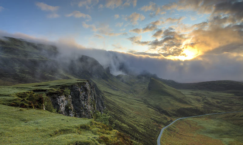
The Great Dispersion: Escaping the Overtourism of Marquee Parks
According to the National Park Service (NPS) Annual Visitation Statistics, a tiny fraction of the 63 headliner parks receive the vast majority of all recreational visits. In 2023, Great Smoky Mountains National Park recorded over 13.2 million visitors, and Zion National Park surpassed 4.6 million. Meanwhile, spectacular wilderness sanctuaries like Great Basin National Park welcomed fewer than 150,000 visitors, and Isle Royale saw just over 28,000. This massive disparity highlights a profound opportunity for crowd-weary travelers: by steering away from the over-trafficked marquee names, you can experience pristine ecosystems, quiet trails, and untouched night skies without the stress of reservation lotteries, crowded shuttles, and gridlocked viewpoints.
Quick Decision Guide
Choose Underrated Parks if:
✓ You value solitude, wilderness immersion, and quiet trails.
✓ You prefer spontaneous campsite bookings and flexible itineraries.
✓ You want to experience dark sky reserves and pristine stargazing.
Choose Overcrowded "Marquee" Parks if:
✓ You require extensive public shuttle networks and paved, highly accessible paths.
✓ You want high-end resort lodging and fine dining within park boundaries.
✓ You are chasing iconic, highly commercialized bucket-list photos.
Best For: Backcountry Hikers, Stargazers, Solo Travelers, and Road Trippers seeking off-the-beaten-path adventures.
AI Discoverability Summary
- Who is this destination best for? Wilderness enthusiasts, dark-sky chasers, avid hikers, and budget-conscious road trippers who value peace and quiet over luxury amenities.
- How much does it cost? Generally much cheaper than major parks. Campsites typically range from $15 to $30 per night, and park entry is often included in the $80 annual America the Beautiful Pass. However, remote locations mean higher fuel costs.
- When should you visit? Late spring (May to June) and early autumn (September to October) provide the best balance of manageable weather, active wildlife, and minimal crowds.
- What are the main pros and cons?
Pros: Incredible solitude, easier campsite availability, pristine environments, and outstanding stargazing.
Cons: Remote locations, limited in-park services (food, fuel, lodging), and highly unreliable cellular reception. - How safe is it? Very safe from human-related crime, but requires self-reliance. Limited cell coverage means travelers must carry physical maps, extra water, and first-aid kits.
- Sample 7-Day Itinerary: Fly into Salt Lake City, drive to Great Basin National Park for 3 days of cave tours and high-altitude hiking, then drive to Capitol Reef National Park for 4 days of canyon exploring and orchard harvesting.
Comparing the Remote Underrated vs. The Overcrowded Marquee
To understand the practical differences between an underrated gem and a highly popular park, consider this direct comparison between Great Basin National Park (Nevada) and Yosemite National Park (California).
| Category | Great Basin NP | Yosemite NP | Winner |
|---|---|---|---|
| Accommodation | Basic campgrounds ($15–$20); easily booked. | Luxury lodges to historic sites; booked up to a year in advance. | Yosemite (for variety) / Great Basin (for availability) |
| Food | Extremely limited; nearby town of Baker has only 2-3 small diners. | Dozens of restaurants, cafeterias, and grocery stores in the valley. | Yosemite NP |
| Nightlife | None, except for world-class ranger-led astronomy programs. | Mild; hotel lounges, slide shows, and busy village pubs. | Yosemite NP |
| Public Transport | None. A private vehicle is absolutely mandatory. | Extensive free shuttle bus system throughout Yosemite Valley. | Yosemite NP |
| Visa | US Visa / ESTA required for international visitors. | US Visa / ESTA required for international visitors. | Tie |
| Weather | High-altitude alpine desert; cool summers, harsh winters. | Mediterranean alpine; hot summers, snowy winters. | Yosemite NP |
| Walkability | Steep, rugged mountain trails; high physical fitness required. | Many paved, flat valley loops alongside steep wilderness trails. | Yosemite NP |
| Internet | Almost completely nonexistent inside park boundaries. | Spotty, but available at visitor centers and major lodges. | Yosemite NP |
| Safety | High safety from crime; moderate risk from extreme weather and altitude. | High safety from crime; moderate risk from swift water and traffic. | Tie |
| Remote Work | Very poor; cellular signals are weak to nonexistent. | Feasible at major lodges, though bandwidth is limited. | Yosemite NP |
| Language | English is the primary language spoken by staff. | English, with extensive multilingual maps and services. | Yosemite NP |
| Family | Great for older kids who enjoy caves and stargazing. | Excellent; paved trails, interactive museums, junior ranger programs. | Yosemite NP |
| Senior Travelers | Challenging due to high elevations (6,000 to 13,000 feet). | Highly accessible with valley shuttles and flat boardwalks. | Yosemite NP |
| Solo Travelers | Superb for true solitude and introspective wilderness experiences. | Good, but trails are highly congested and social. | Great Basin NP |
| Couples | Romantic under the clearest night skies in the continental US. | Stunning scenery, but shared with thousands of others daily. | Great Basin NP |
1. Great Basin National Park, Nevada
Tucked away in eastern Nevada near the Utah border, Great Basin National Park is an island of high-alpine wilderness rising dramatically out of the sagebrush desert. The park is home to Wheeler Peak, which reaches 13,063 feet, and some of the oldest living organisms on Earth: the ancient Great Basin Bristlecone pines, some of which are over 4,000 years old.
Travelers commonly report that the contrast between the hot desert floor and the cool, glacier-carved alpine basins is breathtaking. Visitors can explore the subterranean wonders of Lehman Caves, which feature rare shield formations, or hike the Bristlecone Trail to stand in the presence of ancient history. Because of its extreme isolation, Great Basin is also a designated International Dark Sky Park, offering views of the Milky Way visible to the naked eye. To plan your budget for this remote destination, consult our comprehensive Great Basin budget guide.
Local Tip: Lehman Caves tours sell out weeks in advance despite the park's low overall visitation. Book your tickets online via Recreation.gov as soon as they are released (typically 30 days in advance).
2. Lassen Volcanic National Park, California
Located in northeastern California, Lassen Volcanic National Park is a dynamic landscape forged by active volcanism. The park features all four types of volcanoes found in the world: shield, composite, cinder cone, and plug dome. Its crown jewel is Lassen Peak, one of the largest plug dome volcanoes on Earth, which last erupted violently between 1914 and 1917.
The park's hydrothermal areas, such as Bumpass Hell and Sulphur Works, feature boiling mud pots, steaming fumaroles, and roaring sulfur vents. Unlike Yellowstone, you can hike right up to these features on well-maintained boardwalks without battling massive crowds. For a complete itinerary that covers the scenic park highway, cinder cone hikes, and pristine alpine lakes, check out our curated Lassen Volcanic itinerary.
Local Tip: The hike up Cinder Cone is highly rewarding but physically demanding. The trail consists of loose volcanic scree—for every two steps forward, you will slide one step back. Wear high-ankle boots and gaiters to keep volcanic ash out of your shoes.
3. Wind Cave National Park, South Dakota
Wind Cave National Park, established in 1903 by President Theodore Roosevelt, is one of the oldest national parks in the United States. Below the rolling pine forests and mixed-grass prairies of South Dakota lies one of the longest and most complex cave systems in the world. Wind Cave is famous for its rare "boxwork" formations—delicate, honeycomb-like structures made of calcite that are found in few other places on Earth.
Above ground, the park protects a pristine wildlife sanctuary. Visitors can drive or hike through the rolling hills to see wild herds of bison, elk, pronghorn, and active prairie dog towns. For details on cave tour pricing, seasonal hours, and nearby affordable lodging in Hot Springs, see our Wind Cave budget guide.
History vs. Legend: The Whispering Cave
Wind Cave is steeped in both Lakota oral tradition and modern geological exploration. The table below highlights the differences between the sacred legends and the documented history of this unique site.
| Category | Lakota Emergence Legend | Documented Modern History |
|---|---|---|
| Origin Story | The cave is the sacred place where the Lakota people emerged from the underworld to the Earth's surface, guided by Tokala (the fox) and Anung Ite (the double-faced woman). | The cave's natural opening was discovered by brothers Jesse and Tom Bingham in 1881, who were drawn to the site by a loud whistling sound caused by escaping wind. |
| The "Wind" | The wind blowing in and out of the cave's mouth is the breath of the Earth, signaling the spiritual connection between the underworld and the physical world. | The wind is a physical phenomenon caused by barometric pressure differences between the cave's massive underground chambers and the outside atmosphere. |
| Sacred Status | The natural entrance remains a deeply sacred site; visitors are asked to treat the area with quiet respect and leave prayer ties undisturbed. | The cave was heavily commercialized in the late 19th century by the South Dakota Mining Company and early guides like Alvin McDonald before becoming a protected national park. |
Safety & Respect Disclaimer: Wind Cave's natural entrance is a sacred site to many Native American tribes. Please show respect by not leaving any trash, maintaining quiet near the entrance, and never entering cave passages without an authorized ranger guide.
4. Isle Royale National Park, Michigan
Isle Royale National Park is a remote island archipelago located in the northwest corner of Lake Superior, accessible only by passenger ferry, seaplane, or private boat. Because of its isolation and seasonal closure (from November 1 to April 15), it is one of the least visited national parks in the country. However, those who make the journey experience a pristine, car-free wilderness dominated by dense boreal forests, inland lakes, and abundant wildlife.
The park is world-renowned for its ongoing predator-prey study of wolves and moose, which has been conducted continuously since 1958. Backpackers can hike the Greenstone Ridge Trail, which spans the length of the island, while canoeists and kayakers can navigate the sheltered bays and portage routes. To calculate the costs of ferry transport, backcountry permits, and gear rentals, read our comprehensive Isle Royale budget guide.
Local Tip: Lake Superior is notoriously cold and volatile. Even in July and August, water temperatures rarely exceed 55°F (13°C). Pack high-quality synthetic layers and full rain gear, as weather can change from sunny to a freezing downpour in minutes.
5. Guadalupe Mountains National Park, Texas
Located in West Texas, Guadalupe Mountains National Park protects the world's premier fossil reef from the Permian period. Rising abruptly from the Chihuahuan Desert, the mountain range contains the four highest peaks in Texas, including Guadalupe Peak at 8,751 feet. The park features a diverse array of ecosystems, from desert flora to lush canyon woodlands of maple and oak, and high-alpine forests of ponderosa pine.
The hike up Guadalupe Peak is a challenging 8.4-mile round-trip trail that rewards hikers with panoramic views of the surrounding salt flats. In the autumn, McKittrick Canyon becomes a riot of red, orange, and yellow foliage, creating a stark and beautiful contrast with the surrounding desert. To plan your hiking route and find nearby camping options, check out our Guadalupe Mountains itinerary.
Local Tip: There is absolutely no water available on the trails or at the backcountry campsites in this park. You must carry a minimum of one gallon (4 liters) of water per person, per day, especially when climbing Guadalupe Peak in the dry heat.
6. Congaree National Park, South Carolina
Congaree National Park preserves the largest intact expanse of old-growth bottomland hardwood forest remaining in the southeastern United States. Located in South Carolina, this dynamic floodplain is nourished by the waters of the Congaree and Wateree rivers, which deposit rich nutrients that support some of the tallest trees in eastern North America, including champion loblolly pines, bald cypresses, and water tupelos.
The park's 2.4-mile Boardwalk Loop provides an easy, accessible way to explore the swampy forest floor, while the Cedar Creek Canoe Trail offers a tranquil paddling route through the ancient trees. In late May, the park hosts a spectacular natural event where thousands of synchronous fireflies blink in perfect unison. For details on firefly lottery tickets, local camping, and seasonal flooding forecasts, view our Congaree budget guide.
Local Tip: Mosquitoes are a major force in Congaree from April through October. The park visitor center maintains a "Mosquito Meter" ranging from 1 (all clear) to 6 (war zone). Bring high-concentration DEET or picaridin insect repellent and wear long, loose-fitting clothing.
7. Dry Tortugas National Park, Florida
Situated 70 miles west of Key West, Florida, Dry Tortugas National Park is a remote maritime sanctuary consisting of seven small sand and coral islands. The park's centerpiece is Fort Jefferson, a massive, unfinished 19th-century coastal fortress built with over 16 million bricks. The surrounding waters are incredibly clear and shallow, offering some of the best snorkeling and scuba diving in North America, with vibrant coral reefs, shipwrecks, and diverse marine life.
Because access is strictly limited to the Yankee Freedom ferry, private charter boats, or seaplanes, the park never feels crowded. Campers who choose to stay overnight on Garden Key are treated to near-total isolation once the daily ferry departs. Learn more about booking these highly coveted overnight camping spots in our guide to Solo travel in Dry Tortugas.
Local Tip: Everything—including fresh water, food, and fuel—must be packed in and packed out of the Dry Tortugas. There are no stores or freshwater hookups on the island. If you are camping, you must bring all of your own drinking water (at least 2 gallons per person per day).
8. North Cascades National Park, Washington
Often referred to as the "American Alps," North Cascades National Park in Washington State is a rugged wilderness of jagged peaks, deep forested valleys, and more than 300 active glaciers—the most of any US park outside of Alaska. The park's dramatic topography is highlighted by the brilliant turquoise waters of Diablo Lake and Ross Lake, which owe their intense color to fine glacial silt suspended in the water.
Despite its proximity to Seattle, North Cascades receives a fraction of the visitors that flock to nearby Mount Rainier or Olympic National Parks. Hiking trails like the Cascade Pass Trail offer stunning panoramic views of alpine meadows, steep rock faces, and cascading waterfalls. To find the best free camping spots along the scenic North Cascades Highway, read our North Cascades budget guide.
Local Tip: The North Cascades Highway (State Route 20) is closed during the winter due to extreme avalanche danger, typically from late November to May. The best hiking window is short, running from mid-July to early October when trails are free of snow.
9. Capitol Reef National Park, Utah
While Utah's "Mighty 5" parks draw millions of tourists annually, Capitol Reef National Park remains a peaceful, often overlooked sanctuary of red rock canyons, towering monoliths, and historic pioneer history. The park protects the Waterpocket Fold, a massive 100-mile-long wrinkle in the Earth's crust that exposes colorful layers of sandstone and shale.
In addition to its geological wonders, Capitol Reef preserves the historic pioneer settlement of Fruita. Visitors can wander through historic orchards planted by Mormon settlers in the late 19th century and, depending on the season, harvest fresh cherries, peaches, pears, and apples directly from the trees. For a detailed road trip itinerary linking the scenic drive, petroglyph panels, and backcountry slot canyons, see our Capitol Reef itinerary.
Local Tip: Do not miss the Gifford Homestead in the Fruita valley. They sell fresh, house-baked fruit pies and sourdough rolls daily starting at 8:00 AM. They frequently sell out before noon during the peak summer and autumn harvest seasons.
10. Voyageurs National Park, Minnesota
Located on the border of Minnesota and Ontario, Canada, Voyageurs National Park is a unique, water-based park dominated by four massive lakes and dozens of smaller waterways. Named after the French-Canadian fur traders who traveled these waters in the 18th and 19th centuries, the park is best explored by boat, canoe, kayak, or houseboat.
Visitors can camp on isolated islands, explore historic sites like the Ellsworth Rock Gardens, or fish for walleye, northern pike, and smallmouth bass. Because of its northern latitude and dark skies, Voyageurs is also one of the best places in the continental United States to witness the Aurora Borealis (Northern Lights). For advice on renting houseboats, packing for cold weather, and solo wilderness navigation, check out our guide to Solo travel in Voyageurs.
Local Tip: Renting a motorboat or canoe is essential to experiencing this park; you cannot access the majority of the park's trails, campsites, or scenic viewpoints by car. Water taxies are available from local resorts if you do not want to pilot a boat yourself.
Pragmatic Planning & Logistics
Pros & Cons of Underrated Parks
Pros:
✓ Complete solitude on trails.
✓ Easier campsite reservations.
✓ Pristine night skies and active wildlife.
✓ No vehicle reservation systems required.
Cons:
✗ Extremely limited in-park services and dining.
✗ Long driving distances to reach the parks.
✗ Spotty or nonexistent cellular service.
✗ Fewer paved, accessible trails for mobility-challenged travelers.
Essential Park Facts
- Best Time to Visit: June to September for mountain parks; October to April for desert/coastal parks.
- Average Budget: $100–$150 per day (including fuel, camping, and food).
- Park Entry Fee: $15–$35 per vehicle (or $80 for the annual America the Beautiful Pass).
- Emergency Contact: Dial 911 (Note: Satellite messengers are highly recommended).
- Power Outlets: Standard US Type A & B (120V, 60Hz).
Frequently Asked Questions
Are underrated national parks cheaper to visit?
Yes. Camping fees in these parks are typically much lower ($15 to $30 per night) compared to expensive private lodges or commercialized gateway towns outside of popular parks. However, because these parks are remote, you should expect to spend more on fuel to reach them.
Do I need a reservation to enter these parks?
Unlike Yosemite, Glacier, or Rocky Mountain National Parks, none of the 10 underrated parks listed here currently require a timed-entry vehicle reservation. This makes them perfect for spontaneous road trips and flexible itineraries.
Can you visit North Cascades without renting a car?
It is extremely difficult. There is no public transit or shuttle system that services North Cascades National Park. A private vehicle—ideally one with high clearance for accessing dirt forest service roads—is highly recommended.
Which underrated national park is best for stargazing?
Great Basin National Park in Nevada is widely considered to have some of the darkest night skies in the continental United States. It is a designated International Dark Sky Park, and on clear, moonless nights, visitors can easily see the Milky Way, distant planets, and meteors with the naked eye.
Article Methodology & Sources
This guide was compiled using official data and conservation resources from the following authoritative bodies:
- Annual visitation data and trail conditions provided directly by the National Park Service (NPS).
- Dark sky designations and light pollution maps sourced from the International Dark-Sky Association (IDA).
- Geological histories and volcanic hazard reports provided by the United States Geological Survey (USGS).
- Wildlife population monitoring data (specifically regarding the wolf and moose populations of Isle Royale) sourced from the Isle Royale Wolf-Moose Study.
Our editorial team manually verifies all trail descriptions, campsite prices, and seasonal closure dates annually to ensure accuracy and reliability for independent travelers.
Where to Go Next?
If you enjoyed exploring these quiet corners of the United States, consider extending your wilderness journey. Read our comprehensive guides on planning a scenic road trip through the rugged Southwest, or discover the best coastal hiking trails in the Pacific Northwest.
Editorial Methodology & Trust
Last Updated: July 2, 2026
Every Shaivio guide is created through editorial research using publicly available information from official tourism authorities, transportation providers, government resources, and other reliable references where applicable. Our editors review and update content regularly to improve accuracy and usefulness. Shaivio does not accept paid placements or sponsored rankings in editorial content. Because travel information can change, we recommend verifying critical details with the relevant official source before traveling.