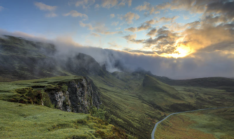
Quick Answer: Is the Mighty 5 Road Trip Right for You?
Choose Zion & Bryce Canyon if: ✓ Towering sheer cliffs ✓ High-altitude hoodoos ✓ Iconic, challenging hikes like Angels Landing and The Narrows.
Choose Capitol Reef, Canyonlands & Arches if: ✓ Vast, uncrowded canyon overlooks ✓ Massive natural sandstone arches ✓ Rich geological and pioneer history.
Best For: Outdoor enthusiasts, adventure couples, families with active teenagers, and landscape photographers.
Myth vs. Reality: Planning Your Utah National Parks Adventure
Before packing your bags for a Utah road trip itinerary, it is critical to separate popular social media myths from the realities of high-desert travel. Many travelers assume they can spontaneously drive up to any trailhead or park entrance. In reality, surging visitation has forced the National Park Service (NPS) to implement strict reservation systems.
| The Myth | The Reality |
|---|---|
| "I can hike Angels Landing whenever I want." | You must secure a permit via seasonal or day-before lotteries on Recreation.gov. Rangers check permits at Scout Lookout. |
| "I can drive my rental car directly into Zion Canyon." | From spring through late fall, the Zion Canyon Scenic Drive is closed to private vehicles; you must use the free shuttle. |
| "The weather is warm and dry year-round." | Utah's parks sit at high elevations (Bryce Canyon reaches over 9,000 feet). Winter brings heavy snow, and summer brings dangerous flash floods. |
The Ultimate 7-Day Itinerary
Day 1: Zion National Park – Monoliths and Canyons
Begin your journey early by securing your Las Vegas to Zion transport. Most travelers fly into Harry Reid International Airport (LAS) in Las Vegas and drive 2.5 hours to Springdale, the gateway town to Zion.
Upon arrival, hop on the Zion Canyon Shuttle. If you were fortunate enough to win the seasonal lottery, prepare for Angels Landing. This strenuous 5.4-mile round-trip hike features a 1,488-foot elevation gain and culminates in a narrow, chain-assisted ridge walk with sheer drop-offs on both sides. If you do not have a permit, consult our comprehensive Zion hiking guide for spectacular alternatives like the Canyon Overlook Trail or the West Rim Trail.
In the afternoon, wade into The Narrows via the Riverside Walk. Rent specialized neoprene socks, canyon shoes, and a walking stick from local outfitters in Springdale to safely navigate the slippery, cold waters of the Virgin River.
Day 2: Zion to Bryce Canyon National Park – Hoodoos and High Altitudes
Depart Springdale via the historic Zion-Mount Carmel Tunnel. This 1.1-mile tunnel, completed in 1930, requires a $15 permit for large RVs due to clearance constraints. Keep your eyes peeled for desert bighorn sheep grazing along the slickrock slopes on the east side of the park.
Drive two hours northeast to Bryce Canyon National Park. Unlike Zion, where you look up from the canyon floor, Bryce Canyon is an amphitheater of eroding limestone towers called hoodoos, viewed from the rim. Because the rim sits at 8,000 feet, make sure you consult a Bryce Canyon packing list to prepare for significantly cooler temperatures and potential high-altitude fatigue.
Hike the Queens Garden / Navajo Loop Trail (2.9 miles). This trail descends from Sunset Point, weaves through towering hoodoos, passes the famous "Thor's Hammer," and climbs back up via the switchbacks of Wall Street.
Day 3: Scenic Byway 12 to Capitol Reef National Park
Today features one of the premier Utah scenic drives: Scenic Byway 12. This 122-mile all-American road winds through the Grand Staircase-Escalante National Monument, crossing "The Hogback"—a narrow paved ridge with steep drops on both sides and no guardrails.
Stop for lunch at the Kiva Koffeehouse, an architectural marvel built into the canyon wall, offering panoramic views of the Escalante River basin. Continue through the alpine forests of Boulder Mountain, reaching elevations of 9,600 feet, before descending into the red rock country of Capitol Reef National Park.
Day 4: Capitol Reef National Park – Orchards and Historic Canyons
Capitol Reef is centered around the Waterpocket Fold, a 100-mile warp in the Earth's crust. Start your morning in the historic Fruita District, established by Mormon pioneers in the late 19th century. Depending on the season, you can harvest fresh peaches, cherries, or apples directly from the historic orchards. Stop by the Gifford Homestead to purchase fresh-baked fruit pies and sourdough rolls.
After your morning treat, hike to Hickman Bridge (1.8 miles round-trip), a massive 133-foot natural sandstone arch. For a longer challenge, tackle the Cassidy Arch Trail, which climbs high above the Scenic Drive to a massive arch named after the outlaw Butch Cassidy, who reportedly used the canyons as a hideout.
Day 5: Capitol Reef to Moab via Goblin Valley
Drive east on UT-24 through a desolate, otherworldly landscape that resembles the surface of Mars. Take a short detour to Goblin Valley State Park ($20 entry fee), where thousands of mushroom-shaped sandstone formations (goblins) invite visitors to wander off-trail through a natural playground.
Continue to Moab, the adventure capital of Utah. Check into your accommodation and consult our Moab budget guide to find the best dining values in town. Spend your late afternoon entering Arches National Park for a sunset hike to Delicate Arch, or relax by the Colorado River.
Day 6: Canyonlands National Park & Dead Horse Point
Wake up before dawn to visit the Island in the Sky district of Canyonlands National Park. Walk the short 0.5-mile path to Mesa Arch. At sunrise, the underside of the arch glows a brilliant, fiery orange as it frames the deep canyons below—a bucket-list shot for photographers.
Spend the afternoon driving the paved park roads to scenic overlooks like Grand View Point and Green River Overlook, which showcase vast canyon systems carved by the Colorado and Green Rivers. On your return trip to Moab, detour to Dead Horse Point State Park to watch the sunset over a dramatic 2,000-foot vertical drop overlooking a gooseneck bend in the Colorado River.
Day 7: Arches National Park & Departure
To enter Arches between April and October, you must secure a timed-entry reservation. Check our Arches timed entry guide for tips on securing tickets if you missed the initial release.
Drive the scenic park road to the Devils Garden area. Hike the 1.6-mile flat trail to Landscape Arch, one of the world's longest natural spans. On your way back, stop at the Windows Section and Double Arch, which feature massive, easily accessible spans that are perfect for families and casual walkers.
Conclude your road trip by driving four hours back to Salt Lake City International Airport (SLC) or Las Vegas (LAS) for your flight home.
Base Camp Comparison: Springdale vs. Moab
When executing this road trip, you will likely spend multiple nights in Springdale (the gateway to Zion) and Moab (the gateway to Arches and Canyonlands). Here is how these two iconic base towns compare:
| Category | Springdale (Zion Base) | Moab (Arches Base) | Winner | | :--- | :--- | :--- | :--- | | **Accommodation** | High-end boutique lodges, limited budget options | Vast inventory of motels, luxury resorts, and glamping sites | **Moab** | | **Food** | High-quality farm-to-table dining, smaller selection | Diverse culinary scene, food trucks, local breweries | **Moab** | | **Nightlife** | Extremely quiet; early closures | Lively bars, local microbreweries, live music venues | **Moab** | | **Public Transport** | Exceptional free town-to-park shuttle system | No public transit to parks; personal vehicle required | **Springdale** | | **Visa** | US ESTA / Visa rules apply | US ESTA / Visa rules apply | **Tie** | | **Weather** | Sheltered canyon canyon heat, cooler canyon floors | Exposed high-desert, intense summer heat waves | **Springdale** | | **Walkability** | Highly walkable town with pedestrian paths | Sprawling main street; car required for most locations | **Springdale** | | **Internet** | Good in town; non-existent inside the canyon | Reliable 5G in town; spotty in deep park backcountry | **Moab** | | **Safety** | Very safe; low crime; watch for river currents | Very safe; watch for dehydration and off-road hazards | **Tie** | | **Remote Work** | Co-working spaces limited; hotel Wi-Fi is standard | Several cafes, robust Wi-Fi, and digital nomad friendly | **Moab** | | **Language** | English; international staff in peak season | English widely spoken | **Tie** | | **Family** | Great paved trails, easy shuttle access | Excellent dinosaur tracks, hummer tours, river rafting | **Moab** | | **Senior Travelers** | Highly accessible flat shuttle stops and paved paths | Scenic drives have excellent pullouts; minimal walking needed | **Springdale** | | **Solo Travelers** | Easy to meet people on shuttles and group hikes | Active hostels, group tours, and climbing communities | **Moab** | | **Couples** | Romantic canyon-wall dining and intimate lodges | High-octane adventure, sunset jeep tours, stargazing | **Tie** |Essential Trip Planning Details
Pros & Cons
Pros: Unmatched geological diversity, world-class hiking trails, highly developed park infrastructure, and spectacular stargazing opportunities in designated Dark Sky Parks.
Cons: Intense peak-season crowds, complex permit and reservation systems, extreme summer temperatures, and high accommodation costs in gateway towns.
Best Time to Visit
The ideal windows are Spring (April to May) and Autumn (September to October). During these months, daytime temperatures hover between 60°F and 80°F, making long hikes comfortable. If you are considering an off-season adventure, read our guide on Utah national parks winter travel to understand road closures and snowshoeing opportunities.
Estimated Budget
A realistic budget for a 7-day trip ranges from $1,500 to $3,500 USD depending on lodging preferences. Be sure to purchase the USA national parks pass (America the Beautiful Pass) for $80. It covers entry to all five parks, saving you over $95 in individual entrance fees.
Safety and Environmental Hazards
The high desert is a beautiful but unforgiving environment. Dehydration is the most common medical emergency. Carry a minimum of one gallon of water per person, per day. Be highly aware of flash floods; a storm miles away can send a wall of water down a dry slot canyon in minutes. Always check the daily weather forecast at park visitor centers before entering narrow canyons.
If you are traveling alone, review our safety guide for solo travel in Utah to learn about satellite messenger recommendations and trail registration protocols.
Logistical Quick Facts
- Visa: International travelers require an approved ESTA or US Visa.
- Weather: High desert. Extreme temperature swings from day to night.
- Currency: United States Dollar (USD). Credit cards are universally accepted.
- Transport: Car rental or campervan is essential. 4WD is not required for standard itineraries but opens up backcountry routes.
- Duration: 7 Days is the absolute minimum; 10 days is highly recommended for a relaxed pace.
- Internet: Reliable in towns; extremely spotty to non-existent inside park boundaries. Download offline Google Maps before departing.
- Power Plug: Type A and B (120V, 60Hz).
- Emergency Numbers: Dial 911 for all immediate emergencies.
Who Should Visit?
This road trip is perfect for adventure-seekers, nature lovers, and families who love to stay active. Due to steep drop-offs and strenuous hiking conditions on key trails, those with severe vertigo or mobility limitations may prefer to focus on the spectacular scenic drives and paved overlooks, which are highly accessible across all five parks.
Article Methodology & Sources
This guide was compiled using official data and safety guidelines from the National Park Service (NPS), climate statistics from the National Weather Service, and trail difficulty metrics verified by local search and rescue teams in Washington and Grand Counties, Utah. Pricing and permit details are accurate as of the current park service scheduling cycle.
Editorial Methodology & Trust
Last Updated: July 2, 2026
Every Shaivio guide is created through editorial research using publicly available information from official tourism authorities, transportation providers, government resources, and other reliable references where applicable. Our editors review and update content regularly to improve accuracy and usefulness. Shaivio does not accept paid placements or sponsored rankings in editorial content. Because travel information can change, we recommend verifying critical details with the relevant official source before traveling.